As a native New Yorker, one of the most common questions I get asked is which part of the city has the most people. It comes up constantly, whether I am talking to visitors or to people who know the city mainly from movies and television.
It is funny, but many people who are not from here, especially those who are not from the East Coast, still think of New York City as just Manhattan. They do not realize that four other boroughs make up the rest of the city, each with its own identity, geography, population, and character.
For everyone who knows there are five boroughs and has wondered the same thing, this article breaks down each one by population, land area, and population density. The answer depends on how the question is asked: Brooklyn has the most residents, while Manhattan has the greatest concentration of people.
Brooklyn Has the Most People; Manhattan Is the Most Densely Populated
New York City recorded 8,804,190 residents in the 2020 U.S. Census. The city consists of five boroughs, each corresponding to a New York State county: Manhattan is New York County, Brooklyn is Kings County, Queens is Queens County, the Bronx is Bronx County, and Staten Island is Richmond County. The modern consolidated city and its five-borough structure took effect on January 1, 1898.
If the question is which borough has the most people, the answer is Brooklyn, with a 2020 Census population of 2,736,074. If the question is which borough is the most crowded, meaning which has the greatest number of residents per square mile, the answer is Manhattan. Its population density of 74,781 people per square mile makes it the densest borough in New York City and the densest county in the United States.
The rankings below run from 1, the most densely populated borough, to 5, the least densely populated. Population, land-area, and density figures use the 2020 U.S. Census so that every borough is measured with the same official data set. The New York City Department of City Planning estimates that the city had approximately 8.58 million residents in July 2025.
New York City Borough Density Rankings
| Rank | Borough | Population | Land Area | Density per Sq. Mile |
|---|---|---|---|---|
| 1 | Manhattan | 1,694,251 | 22.7 sq. mi. | 74,781 |
| 2 | Brooklyn | 2,736,074 | 69.4 sq. mi. | 39,438 |
| 3 | The Bronx | 1,472,654 | 42.2 sq. mi. | 34,920 |
| 4 | Queens | 2,405,464 | 108.7 sq. mi. | 22,125 |
| 5 | Staten Island | 495,747 | 57.5 sq. mi. | 8,618 |
5. Staten Island (Richmond County)
| Population | 495,747 |
|---|---|
| Land Area | 57.5 square miles (149.0 km²) |
| Population Density | 8,618 people per square mile (3,327 per km²) |
Staten Island is the least densely populated borough in New York City, with fewer than one-eighth as many residents per square mile as Manhattan. Its 495,747 residents are spread across 57.5 square miles of land, giving it the smallest population of the five boroughs by a wide margin. It is also the most suburban in character, with extensive areas of detached homes, parks, shoreline, and protected green space.
Staten Island is connected to Brooklyn by the Verrazano-Narrows Bridge and to Manhattan by the Staten Island Ferry, which carries passengers across New York Harbor. The island became part of the consolidated City of New York in 1898. Long known as Richmond, the borough was officially renamed Staten Island in 1975, although the county retained the name Richmond County. Major attractions include the Staten Island Greenbelt, Historic Richmond Town, Snug Harbor Cultural Center and Botanical Garden, and the Staten Island Zoo.
4. Queens (Queens County)
| Population | 2,405,464 |
|---|---|
| Land Area | 108.7 square miles (281.6 km²) |
| Population Density | 22,125 people per square mile (8,542 per km²) |
Queens is the fourth-most densely populated borough, with 22,125 people per square mile. However, it is the largest borough by land area, covering 108.7 square miles, more than four times the land area of Manhattan. Despite being the second-most populous borough, its size produces a substantially lower overall density than Manhattan, Brooklyn, or the Bronx.
Queens occupies the western portion of Long Island, north and east of Brooklyn. It includes intensely urban neighborhoods as well as lower-density communities with detached homes and tree-lined streets. The borough is known for its extraordinary cultural and linguistic diversity, with residents drawn from nations around the world and hundreds of languages spoken across its neighborhoods.
In 1898, the western portion of Queens County joined the consolidated City of New York as the Borough of Queens. The county’s eastern towns separated in 1899 to form Nassau County, making the modern borough and Queens County coextensive. Queens is home to John F. Kennedy International Airport, LaGuardia Airport, Citi Field, Flushing Meadows-Corona Park, the Queens Museum, and neighborhoods that preserve the identities of generations of immigrants.
3. The Bronx (Bronx County)
| Population | 1,472,654 |
|---|---|
| Land Area | 42.2 square miles (109.2 km²) |
| Population Density | 34,920 people per square mile (13,482 per km²) |
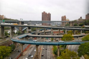
The Bronx is the third-most densely populated borough in New York City, with 34,920 people per square mile across 42.2 square miles of land. It is the northernmost borough and the only one located primarily on the mainland of the United States. The Harlem River separates most of the Bronx from Manhattan, while several bridges connect it to Manhattan and Queens.
The borough takes its name from Jonas Bronck, who settled in the area during the 17th century. Sections of what is now the Bronx were annexed from Westchester County into New York County in 1874 and 1895. The area became the Borough of the Bronx during the 1898 consolidation, and Bronx County was created in 1914.
The Bronx is home to Yankee Stadium, the Bronx Zoo, the New York Botanical Garden, and Pelham Bay Park, the largest public park in New York City. It also includes Fordham University, Lehman College, and Manhattan University. The borough is widely recognized as the birthplace of hip-hop, which emerged from parties and community culture in the South Bronx during the 1970s.
2. Brooklyn (Kings County)
| Population | 2,736,074 |
|---|---|
| Land Area | 69.4 square miles (179.7 km²) |
| Population Density | 39,438 people per square mile (15,227 per km²) |
Brooklyn is the most populous borough in New York City, with 2,736,074 residents recorded by the 2020 Census. If it were an independent city, its population would place it among the largest cities in the United States. Brooklyn is also the second-most densely populated borough, with 39,438 people per square mile spread across 69.4 square miles of land.
Brooklyn occupies the western end of Long Island and includes a long shoreline along the Atlantic Ocean, New York Harbor, and Jamaica Bay. It is known for its cultural and ethnic diversity, architectural heritage, independent arts communities, and neighborhoods whose identities often feel as strong as those of entire cities.
The City of Brooklyn existed as an independent municipality from 1834 until January 1, 1898, when it became part of the consolidated City of New York. By the time of consolidation, Brooklyn had expanded to encompass Kings County. The borough is home to Coney Island, Prospect Park, the Brooklyn Bridge, the Brooklyn Museum, the Brooklyn Botanic Garden, and Downtown Brooklyn, one of the city’s largest central business districts outside Manhattan.
1. Manhattan (New York County)
| Population | 1,694,251 |
|---|---|
| Land Area | 22.7 square miles (58.7 km²) |
| Population Density | 74,781 people per square mile (28,872 per km²) |
Manhattan is the most densely populated borough in New York City and the densest county in the United States. Nearly 1.7 million residents occupy just 22.7 square miles of land, making Manhattan geographically the smallest borough but the one with by far the greatest concentration of people.
Most of the borough is situated on Manhattan Island at the meeting point of the Hudson, East, and Harlem rivers. Manhattan also includes Roosevelt Island, Governors Island, Randall’s Island, Wards Island, Marble Hill, and several smaller islands. The borough is generally divided into Lower Manhattan, Midtown, and Uptown, with Central Park separating the Upper East Side and Upper West Side and Harlem extending north of the park.
Manhattan is the financial, governmental, media, and cultural center of New York City. It is home to Wall Street, Times Square, the United Nations Headquarters, Central Park, Broadway’s theater district, and many of the city’s best-known skyscrapers. Its daytime population rises sharply as commuters, students, tourists, and other visitors arrive from the outer boroughs and the surrounding metropolitan region.
Which NYC Borough Has the Most People?
Brooklyn has the largest population, with 2,736,074 residents in the 2020 Census. Manhattan ranks third in total population, but it is the most densely populated borough because those residents occupy only 22.7 square miles of land. Queens has the most land, while Staten Island has both the smallest population and the lowest population density.
Population and land-area figures use the 2020 U.S. Census. The latest citywide estimate cited in this article is from the New York City Department of City Planning for July 2025.
What Is the Most Populated Borough in NYC? Ranking New York’s 5 Boroughs by Density & Size article published on ClassicNewYorkHistory.com © 2026