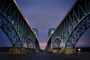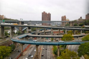
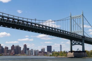
The Triborough Bridge connecting Queens and Wards Island, with Manhattan in the background. Photo: James Andrews1 / Shutterstock.com
It is difficult to travel very far across New York City without encountering something Robert Moses built, promoted, or tried to build. A driver crossing the Triborough Bridge, a family spending the afternoon at Orchard Beach, and a baseball fan remembering Shea Stadium are all encountering different parts of the same history. So are the people who live beside the Cross Bronx Expressway or in the apartment towers that replaced older Manhattan neighborhoods. Moses’s influence was never limited to bridges and highways. He helped determine where New Yorkers could swim, where they could live, how they traveled, and which parts of the city would be cleared for something new.
His authority was extraordinary, especially for someone who never won an election to public office. Beginning in the 1920s, Moses accumulated overlapping state and city positions, including leadership of major park, bridge, and redevelopment agencies. He served as New York City’s parks commissioner from 1934 to 1960, while his control of toll-producing transportation authorities gave him influence over projects well beyond the parks system. Governors, mayors, architects, engineers, and federal officials were also involved in these developments. Moses did not personally design every structure bearing his imprint, but he was often the person who secured the financing, assembled the land, pushed through approvals, and insisted that a plan move forward.
That produced an enduring argument about what constitutes progress. New swimming pools, beaches, bridges, and parks brought recreation and mobility to millions. At the same time, highway construction and urban renewal uprooted families, divided neighborhoods, and often gave automobiles priority over the people already living in their path. Some of Moses’s proposed roads were defeated, and those victories changed the city’s future too. The following 25 places are all within the five boroughs. Together, they show both what New York gained and what it lost during the decades when Robert Moses wielded so much power.
1. The Triborough Bridge (Robert F. Kennedy Bridge)
When the Triborough Bridge opened in July 1936, it joined Manhattan, Queens, and the Bronx in a way no single New York crossing had done before. It was actually a network of bridges, ramps, and connecting roadways, with Randall’s and Wards Islands at its center. Construction had begun before Moses took control, but he played a central role in rescuing the stalled project and bringing it to completion. The engineer Othmar Ammann was responsible for major design work.
The project’s importance extended well beyond the traffic crossing its spans. Moses led the Triborough Bridge Authority, whose toll income and bonding powers helped finance additional transportation projects. That financial base became one of the foundations of his political independence. Today’s Robert F. Kennedy Bridge still demonstrates the scale of his ambition: a transportation system organized around regional automobile travel rather than a single neighborhood’s streets.
2. Orchard Beach (The Bronx)
Orchard Beach is one of the clearest examples of the public recreation that made Moses popular. Before his redevelopment program, the Pelham Bay shoreline included smaller beaches, camping areas, and inlets. Under his direction, workers reshaped the coast, filled portions of LeRoy Bay, and created a great crescent-shaped bathing beach with a promenade, bathhouse, and parking facilities. The transformation began in the 1930s and depended heavily on federal New Deal funding and labor.
The new beach was dedicated in 1936, although work continued afterward. It became known as the Bronx Riviera, offering generations of city residents a place to swim and spend the day beside Long Island Sound. The project also displaced people using the earlier shoreline and altered the natural landscape. Orchard Beach therefore reveals both sides of Moses’s park-building methods: ambitious public amenities created through sweeping changes to the land already there.
3. The Cross Bronx Expressway
Few Moses projects remain as controversial as the Cross Bronx Expressway. Constructed in stages during the 1950s and early 1960s, the highway created an east-west route across a densely developed borough. In East Tremont, its path ran through established residential blocks. Families, businesses, and neighborhood organizations fought the route and proposed alternatives, but Moses and the agencies behind the project pressed ahead.
In 1952, more than 1,500 families in East Tremont received eviction notices associated with a section of the project. The loss of homes and streets caused lasting disruption, although the Bronx’s subsequent economic and housing crises had multiple causes and should not be attributed to a single road. The expressway remains important to regional transportation, yet it also stands as a warning about what happens when an infrastructure plan treats a settled neighborhood as an obstacle to be removed.
4. The Verrazzano-Narrows Bridge
The Verrazzano-Narrows Bridge opened between Brooklyn and Staten Island in November 1964, establishing a permanent direct highway connection between those boroughs. Its main span was the longest suspension-bridge span in the world at the time. Othmar Ammann designed the bridge, while Moses, through the Triborough Bridge and Tunnel Authority, was a driving force behind the financing and the decision to build a bridge rather than pursue a tunnel alternative.
For Staten Island, the crossing changed commuting and encouraged development on a scale not previously possible. In Brooklyn, the approaches cut through Bay Ridge, where hundreds of homes were demolished and thousands of people were displaced. The bridge was an engineering achievement with a direct human cost. Its enormous towers still dominate the entrance to New York Harbor, but the story is incomplete without the streets and households removed to make room for its approaches.
5. Lincoln Center and the Lost San Juan Hill Neighborhood
Lincoln Center is one of New York City’s great cultural institutions, but the land beneath it has a history that is easy to overlook. Before the performing-arts complex was built, the surrounding Lincoln Square and San Juan Hill area contained homes, shops, social clubs, and an important Black and Puerto Rican cultural community. In the 1950s, the area became part of a major urban renewal plan administered through a program associated with Moses.
The larger Lincoln Square redevelopment displaced more than 7,000 families and approximately 800 businesses, according to Lincoln Center’s own historical project. That figure refers to the broader renewal area, not only the footprint of the theaters. The Metropolitan Opera House, concert halls, and other new institutions brought cultural prestige and opportunities to the West Side. The cost was the disappearance of a neighborhood whose residents had little control over the decisions that changed their lives.
6. The Henry Hudson Parkway
The Henry Hudson Parkway follows the western edge of upper Manhattan and continues into the Bronx, connecting the city with Westchester County. Developed during the 1930s under an authority led by Moses, it gave motorists a landscaped route along portions of the Hudson River. The parkway is frequently confused with the West Side Highway, but they are distinct roadways: the Henry Hudson Parkway begins at West 72nd Street and extends north.
For drivers, the route offered an alternative to local streets and strengthened connections with the growing suburbs. For waterfront neighborhoods, its construction and later traffic created a durable barrier between some residential streets and the river. Its relationship with Riverside Park is more complicated than a simple story of parkland being replaced by asphalt; the road and park improvements were developed together in important sections. That combination of recreational landscaping and automobile infrastructure was characteristic of Moses’s early work.
7. The Brooklyn-Queens Expressway
The Brooklyn-Queens Expressway tied sections of Brooklyn and Queens into a regional highway network, but its route also divided neighborhoods. The elevated and trench sections brought traffic, noise, and barriers to areas where homes, businesses, and streets had existed before. The consequences were especially visible in parts of Brooklyn that lacked the political influence to bargain for a different alignment.
Brooklyn Heights offers a revealing contrast. Residents objected to an early route that would have cut more directly through their neighborhood. The eventual arrangement placed a portion of the highway beneath the Brooklyn Heights Promenade in a distinctive multilevel structure. That engineering compromise preserved celebrated views while providing a major road below. The BQE thus became a record of competing interests: a highway treated as indispensable to the city, with its effects distributed unevenly from one neighborhood to another.
8. Flushing Meadows-Corona Park
The land that became Flushing Meadows-Corona Park was once known for enormous ash heaps and marshy ground. The area helped inspire the Valley of Ashes in F. Scott Fitzgerald’s The Great Gatsby. Moses championed the transformation of this landscape into the grounds for the 1939–1940 World’s Fair. Landscape architect Gilmore Clarke and many other planners, designers, and workers shaped the fairgrounds.
Moses later played a major role in bringing the 1964–1965 World’s Fair to the same site. That fair left the Unisphere and other structures that remain landmarks in Queens. The fairgrounds also became a vast public park, although the long history of incomplete park improvements has been part of its story. Flushing Meadows is a striking example of land being repurposed repeatedly, from dumping ground to international exhibition site to one of the borough’s largest recreational spaces.
9. Stuyvesant Town and Peter Cooper Village
Stuyvesant Town and Peter Cooper Village changed a large area of Manhattan’s East Side after World War II. Metropolitan Life Insurance Company developed the residential complex on land that had contained the Gas House District and thousands of residents. Moses supported the redevelopment and helped establish the legal and governmental framework that made large-scale clearance and private construction possible.
The project offered modern apartments and open spaces, but its early leasing policies barred Black residents. Moses defended arrangements that left tenant selection to the developer, and the resulting discrimination provoked a major civil rights and fair-housing campaign. That history is essential to understanding the development. The buildings changed the area’s appearance, while the political battle over who could live in them helped shape a much larger debate about housing rights in New York City.
10. Astoria Pool (Queens)
One of Moses’s most visible achievements as parks commissioner was the construction of public swimming pools during the Great Depression. Astoria Pool, beside the East River in Queens, opened in 1936 as part of an ambitious citywide program supported by federal Works Progress Administration funding. Its scale and setting made it an impressive public facility, especially for families who could not afford private clubs or trips to the ocean.
These pools represented a different kind of infrastructure from the highway system. They offered recreation within ordinary city neighborhoods and became part of summer life for generations of New Yorkers. Architects, engineers, laborers, and New Deal officials all contributed; Moses provided administrative direction and political momentum. Astoria Pool is a reminder that his legacy also includes neighborhood amenities intended for people who never owned a car.
11. Co-op City (The Bronx)
Co-op City rose on land formerly occupied by Freedomland U.S.A., the short-lived amusement park in the northeastern Bronx. Developed in the 1960s by the United Housing Foundation under the leadership of Abraham Kazan and his associates, the cooperative was designed to provide apartments and community services for middle-income families. Its towering buildings and planned grounds created an entirely new residential landscape.
Moses supported large cooperative developments and appeared at Co-op City’s 1966 groundbreaking, but it would be inaccurate to say he personally created or designed the project. State financing, labor-backed housing organizations, and other public officials were fundamental to its construction. Co-op City belongs in this history as an example of the housing philosophy Moses championed: large-scale residential projects intended to retain New York families who might otherwise move to the suburbs.
12. The Grand Central Parkway
The Grand Central Parkway runs through Queens and links the Triborough Bridge area with eastern Queens and the wider Long Island road system. Its development helped advance Moses’s vision of interconnected landscaped roads serving beaches, parks, bridges, and growing suburban communities. As with other early parkways, access was designed primarily around private vehicles, which shaped who could conveniently use the network.
The parkway also figures in an enduring dispute over Moses’s intentions. Robert Caro’s biography popularized the account that low parkway bridges deliberately excluded buses used by poorer residents and people of color. Historians have challenged parts of that account, and bridge clearance alone cannot establish an individual motive for every overpass. What is not in doubt is that Moses favored automobile-oriented planning and that his transportation choices affected access to recreation, housing, and employment.
13. Washington Square Park
Washington Square Park is on this list because New Yorkers prevented Moses from rebuilding it the way he wanted. During the 1930s, 1940s, and 1950s, he supported various plans involving automobile routes through or around the park. One proposal would have introduced new roadways beside the Washington Square Arch, threatening a public space already central to Greenwich Village life.
The opposition included neighborhood organizer Shirley Hayes, Edith Lyons, Jane Jacobs, and many other residents and civic figures. Hayes and the Washington Square Park Committee helped shift the debate from the design of a roadway to the possibility of eliminating automobile traffic altogether. The park was closed to ordinary through traffic, with the legal process completed in the early 1960s. The survival of Washington Square as a pedestrian gathering place became one of the defining victories against Moses’s automobile-centered ideas.
14. The Belt Parkway
Opening in major sections in 1940, the Belt Parkway was a centerpiece of Moses’s plan to link Brooklyn and Queens through a landscaped highway system. Portions followed the waterfront and connected with routes serving the Rockaways, southern Brooklyn, eastern Queens, and Long Island. The design reflected his belief that an attractive roadway could become part of the park system as well as a transportation corridor.
The parkway brought regional mobility but also encouraged the use of cars for trips that might otherwise have involved local streets or transit. Along Jamaica Bay, it formed part of a larger program that included shoreline recreation areas and road connections to new beaches. The Belt Parkway is another reminder that Moses’s plans were rarely isolated structures. A bridge, a beach, a parkway, and a parking field could all be pieces of the same intended system.
15. Shea Stadium (Former Site in Queens)
When the Dodgers and Giants departed New York for California after the 1957 season, the city began looking for a way to bring National League baseball back. The New York Mets arrived in 1962, and Shea Stadium opened in Flushing in 1964. Moses supported the Queens stadium site, which fit into his larger plans for Flushing Meadows and the 1964 World’s Fair.
Shea was surrounded by roads and large parking fields, reflecting the era’s emphasis on automobile access, although fans could also reach it on the No. 7 subway line. The stadium became the home of the 1969 and 1986 World Series champion Mets and hosted events far beyond baseball. It was demolished after the 2008 season, and Citi Field rose nearby. Its former site illustrates the way Moses’s land-use decisions continued to shape Queens even after individual structures disappeared.
16. The Major Deegan Expressway
The Major Deegan Expressway runs through the western Bronx, connecting the Robert F. Kennedy Bridge area with highways heading north. Developed in stages, it became part of a regional route carrying traffic between New York City and communities beyond the Bronx. Its construction altered streets and parcels along the Harlem River corridor, including properties acquired for roadway access and approaches.
The original account of the expressway exaggerated the scale of documented displacement by asserting that thousands of homes were destroyed without adequate support for that specific number. The larger point remains: highway building could remove buildings and change the function of surrounding streets. The Major Deegan also encouraged through traffic in a borough whose residential neighborhoods were dealing with many other pressures. Its effect was both practical, in providing a connection, and physical, in making the automobile corridor a permanent part of the landscape.
17. The Throgs Neck Bridge
The Throgs Neck Bridge opened in 1961, creating another crossing between the Bronx and Queens. Designed by Othmar Ammann and built under the Triborough Bridge and Tunnel Authority, it carried regional traffic across the East River at the western end of Long Island Sound. The bridge was intended in part to provide another option for motorists using the Bronx-Whitestone Bridge, which had opened in 1939.
Moses’s solution to increasing traffic demand often involved expanding road capacity. The Throgs Neck Bridge demonstrates both the usefulness and the limits of that approach. The additional crossing helped distribute traffic, but it also became part of a broader system that encouraged more automobile travel. Together, the two nearby suspension bridges remain among the most recognizable engineering landmarks of the eastern Bronx and northern Queens.
18. Randall’s Island and Wards Island
Before their transformation into a major recreation area, Randall’s and Wards Islands supported institutions including hospitals and other public facilities. Moses’s plans connected the islands to the Triborough Bridge project and helped reshape significant portions of their landscape for public recreation. The park opened in 1936 in association with the bridge, although institutional uses did not vanish all at once.
The islands later gained athletic fields, event facilities, and other recreational spaces, while land reclamation gradually joined parts of the landscape that had once been divided by water. This is one of the clearest examples of Moses treating an entire geographic area as an interconnected planning problem. Roads and bridges, parkland, and public institutions were all considered together, sometimes with lasting benefits and sometimes with difficult consequences for earlier uses of the site.
19. The FDR Drive and East River Waterfront
The FDR Drive developed in sections along Manhattan’s eastern edge, with work beginning during the 1930s under Moses’s direction. The roadway connected downtown Manhattan with routes leading north and helped move automobiles around crowded local streets. Certain portions required complex engineering along an already heavily developed and industrial waterfront.
Its construction changed the relationship between neighborhoods and the river. The roadway became a physical barrier in some places, although East River Park and its esplanade were also developed as part of the same era of waterfront improvement. It is misleading to imagine the entire drive appearing in one project or to suggest Moses alone originated the idea of an east-side road. His major contribution was pushing forward and coordinating the highway as a lasting part of Manhattan’s circulation system.
20. The New York Coliseum (Columbus Circle)
The New York Coliseum opened at Columbus Circle in 1956 as a convention and exhibition center developed under Moses’s influence. Its construction required substantial changes to the blocks west of the circle, including removal of existing structures and alteration of the street grid. The center was designed to bring trade shows and large gatherings into a new, purpose-built facility.
Although its architecture attracted criticism, the Coliseum served as an important venue for decades. It eventually became outdated as the city’s convention business moved toward newer facilities. Demolition followed in 2000, and the site was redeveloped as the complex now known as Deutsche Bank Center. The Coliseum’s history shows how a celebrated modernizing project could itself become obsolete and disappear, while the changes to the surrounding streets persisted.
21. The Sheridan Expressway and Sheridan Boulevard
The short Sheridan Expressway in the South Bronx emerged from a much larger highway vision. Planned as a link between major expressways, it was built only in part. Local residents and advocates spent years criticizing its effect on neighborhood streets and access to the Bronx River. The roadway’s existence became an example of the way incomplete expressway plans could still leave lasting physical barriers.
In 2019, New York State completed a project converting the expressway into Sheridan Boulevard, adding street crossings and improving connections toward Starlight Park and the Bronx River waterfront. The conversion did not erase decades of highway impacts, but it was an important reversal of the assumption that a limited-access roadway had to remain that way permanently. Few sites demonstrate more clearly how a city can reconsider an earlier generation’s transportation priorities.
22. Kips Bay Plaza (Kips Bay Towers)
Kips Bay Plaza was a major Manhattan urban renewal development associated with the era of Moses’s slum-clearance programs. The residential complex, later known as Kips Bay Towers, was designed by I. M. Pei. Its two modernist towers and open central grounds were a dramatic departure from the dense blocks and smaller buildings that had occupied the surrounding area.
The project expressed a planning philosophy that favored assembling large sites and placing tall buildings in landscaped open space. Supporters saw improved light, air, and housing conditions; critics questioned the displacement and disruption involved in clearing older neighborhoods. Moses provided political and redevelopment influence, while Pei and the developers made crucial architectural choices. The completed towers stand as one of the most visible New York examples of midcentury urban renewal.
23. Soundview Park (The Bronx)
Soundview Park lies near the meeting of the Bronx River and the East River, on land with a long history of tidal marshes and later filling. The city began acquiring parkland there in 1937, during Moses’s tenure as parks commissioner, and expanded the site in subsequent stages. Portions were reshaped as landfill and recreational land during the twentieth century.
Moses’s administration contributed to the broader transformation of the waterfront, including lagoon work during the 1950s, but Soundview Park was not created in a single dramatic construction campaign. The park’s history is a series of acquisitions, fill operations, improvements, and later environmental restoration. It makes an important point about the Moses years: not every change involved monumental steel or concrete. Some permanently altered the shape and ecology of city shorelines.
24. The Bronx-Whitestone Bridge
The Bronx-Whitestone Bridge opened in 1939, shortly before the New York World’s Fair began in Queens. The new suspension crossing provided a more direct road connection between the Bronx, Queens, and the highway approaches serving the fairgrounds. Its graceful appearance made it one of the city’s major engineering landmarks, but its construction also required the acquisition of land for road approaches on both sides of the river.
Homes and properties in Whitestone and the Ferry Point area were affected by those acquisitions. The original article’s sweeping assertion that entire waterfront communities were destroyed went beyond the evidence; the documented impacts were more specific. The bridge nevertheless made a lasting difference to travel patterns and local development. It also established the road connection whose growing traffic would later help motivate the construction of the nearby Throgs Neck Bridge.
25. Jacob Riis Park (The Rockaways)
Jacob Riis Park in Queens was already a public beach before Moses began his major improvements. Under his administration, it was redesigned with the grand Art Deco bathhouse, broad walkways, and a recreational plan that echoed his earlier work at Jones Beach. The improvements helped turn a stretch of Rockaway shoreline into a destination for city residents seeking relief from summer heat.
The project was linked to another Moses initiative: the Marine Parkway Bridge, which opened in 1937 and made the Rockaways easier to reach from Brooklyn. Federal and city agencies, architects, and workers all contributed to the beach’s transformation. Today the park is part of Gateway National Recreation Area and is managed by the National Park Service. It offers a fitting conclusion to this list because it combines two recurring themes in Moses’s career: opening public recreation to large numbers of people and designing the transportation network around access by automobile.
Robert Moses left behind more than a collection of buildings and roads. His projects altered the way New Yorkers traveled, spent their summers, attended performances, and lived in their neighborhoods. They also helped inspire the movements that challenged the demolition of communities in the name of modernization. For more on this era, read our history of the Triborough Bridge, our detailed look at the Verrazzano-Narrows Bridge, the history of Washington Square Park, the story of the New York Coliseum, and our historical study of how Robert Moses shaped Long Island.