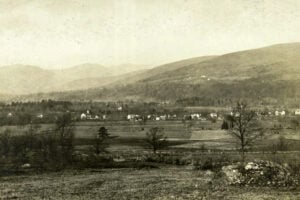
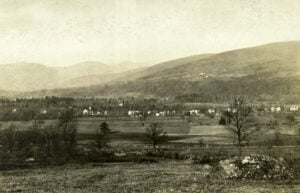
The old village of Shokan in Ulster County before construction of the Ashokan Reservoir transformed the Esopus Valley. Photo: New York Public Library Digital Collections; no known copyright restrictions.
Beneath the calm surfaces of some of Upstate New York’s reservoirs lies a geography that no longer appears on modern road maps. During the twentieth century, major public works projects built to supply drinking water, regulate rivers, and support New York’s canal system displaced entire communities. Farms were condemned, homes and businesses were moved or demolished, cemeteries were relocated, rail lines and roads were rerouted, and residents were forced to rebuild their lives elsewhere.
The story is especially dramatic in the Catskills, where New York City’s expanding water system transformed valleys that had been settled for generations. The construction of the Ashokan, Schoharie, Neversink, and Pepacton reservoirs eliminated or relocated numerous communities while helping create the vast upstate network behind New York City’s drinking water supply. Elsewhere, the creation of Delta Reservoir near Rome erased a village in order to provide water for the New York State Barge Canal. These ten communities reveal the human history beneath some of New York’s most important reservoirs.
Bittersweet
Location: Town of Neversink, Sullivan County
Body of Water: Neversink Reservoir
Year Lost: 1953
Bittersweet was a small rural community in the Town of Neversink whose name is believed to have come from the abundance of bittersweet vines growing in the area. A post office operated there from 1915 until 1920, and the community had a one-room school. When New York City acquired land in the Neversink Valley for a new reservoir, Bittersweet was one of the communities that disappeared. Residents were relocated, the old site was cleared, and the waters of the Neversink Reservoir eventually covered the former hamlet.
Neversink (Old Village)
Location: Sullivan County
Body of Water: Neversink Reservoir
Year Lost: 1953
The original community of Neversink, sometimes called Neversink Flats, was a well-established Catskills hamlet long before the reservoir arrived. Its post office dated to 1828, and the community included homes, churches, schools, a covered bridge, businesses, farms, and boarding houses that served Catskills visitors. Historical mapping of the reservoir area shows that more than one hundred buildings were affected by the project, with dozens of structures located within the area that would ultimately be submerged.
Neversink did not disappear as a name. The community was relocated to higher ground along Route 55, where it survives today. The original village site, however, was lost when the reservoir was completed. Neversink Reservoir was placed into service in 1954 as part of New York City’s Delaware Water Supply System.
Olive Bridge (Original Site)
Location: Town of Olive, Ulster County
Body of Water: Ashokan Reservoir
Year Lost: 1913–1915
The old settlement of Olive Bridge stood in the Esopus Creek valley before construction of the Ashokan Reservoir transformed the Town of Olive. Olive Bridge was one of a group of communities flooded, dismantled, or relocated during the reservoir project. The area around Bishop’s Falls and the Olive Bridge dam site became a major construction zone as New York City prepared the valley to store Catskill water.
Olive Bridge itself survived by relocating south of the new reservoir. The old valley landscape did not. Roads, farms, buildings, and community sites were removed or abandoned as impounding began in 1913. The Ashokan Reservoir was placed into service in 1915, forever dividing the Town of Olive and changing the geography of the Esopus Valley.
Shokan (Old Village)
Location: Town of Olive, Ulster County
Body of Water: Ashokan Reservoir
Year Lost: 1913–1915
Old Shokan was one of the Catskill communities displaced by construction of the Ashokan Reservoir. The surrounding valley had developed around farming, local businesses, boarding houses, and the Ulster and Delaware Railroad, which brought visitors from the Hudson Valley into the Catskills. When the reservoir project moved forward, Shokan was relocated to higher ground north of the new water supply.
The railroad itself had to move. In 1913, the Ulster and Delaware abandoned its old route through the reservoir basin and shifted the tracks to a new alignment north of the water. Shokan’s former site became part of a much larger landscape of disappeared roads, homes, businesses, and community landmarks now associated with the Ashokan Reservoir.
Gilboa (Original Village)
Location: Schoharie County
Body of Water: Schoharie Reservoir
Year Lost: 1925–1926
The original village of Gilboa grew along Schoharie Creek and became an important local center of homes, farms, churches, shops, schools, and industry. When New York City selected the valley for the Schoharie Reservoir, the old village was condemned and its residents were forced to leave. A new settlement was established on higher ground, preserving the Gilboa name while the original community disappeared from the valley floor.
Gilboa also has an extraordinary connection to natural history. Fossilized tree stumps were discovered in the area in 1870, decades before the reservoir was built. Additional fossil material was exposed during excavation and quarrying connected with construction of the dam. The ancient forest remains are now among the best-known scientific treasures associated with Gilboa. The old village was cleared as the reservoir project advanced, and the Schoharie Creek was impounded in the 1920s.
Delta
Location: Oneida County, near Rome
Body of Water: Delta Reservoir
Year Lost: 1912
Unlike the Catskill communities displaced for New York City’s drinking water, Delta disappeared because of a state canal project. The village stood along the upper Mohawk River north of Rome. When New York expanded the Barge Canal system, engineers needed a dependable supply of water for the canal’s summit level near Rome. Construction of Delta Dam began in 1908 to create a reservoir capable of regulating that supply.
The project erased the old village on a remarkable scale. New York State records describe the removal of 295 buildings, including 70 homes, along with the relocation of two cemeteries. Most structures were torn down or moved before inundation. Delta Dam was completed in 1912, and the reservoir preserved the community’s name as Delta Lake. The project became part of the larger story of the Erie Canal and New York’s canal system, but its success came at the cost of an entire village.
Arena
Location: Town of Middletown, Delaware County
Body of Water: Pepacton Reservoir
Year Lost: 1954–1955
Arena stood along the East Branch of the Delaware River and had once been known as Lumberville, a name reflecting the importance of the lumber industry in the valley. By the late nineteenth century, the community included stores, hotels, a church, a school, an Odd Fellows lodge, and other businesses. Later, the railroad connected Arena to markets beyond the Catskills and carried local freight from the valley.
That history ended with construction of the Pepacton Reservoir. New York City began the project in 1947, acquiring thousands of acres along the East Branch. Arena was one of four communities eliminated by the reservoir. Buildings were razed or removed, residents were displaced, and cemetery burials throughout the reservoir area were transferred to new locations. Pepacton Reservoir entered service in 1955.
Pepacton
Location: Delaware County
Body of Water: Pepacton Reservoir
Year Lost: 1954–1955
The community of Pepacton stood along the East Branch of the Delaware River and gave its name to the reservoir that eventually covered its former site. The settlement had roots in the logging and tanning economy of the Catskills and later became part of a valley dominated by farming and small rural communities. Its name came from a Native place name associated with the East Branch, although historical interpretations of its precise meaning have varied.
By the 1940s, Pepacton was one of four communities lying inside the proposed reservoir area. New York City acquired the properties, residents scattered to higher ground and surrounding towns, and the settlement was cleared. Today, the name survives principally through Pepacton Reservoir, the largest reservoir in New York City’s water supply system by volume.
Shavertown
Location: Delaware County
Body of Water: Pepacton Reservoir
Year Lost: 1954–1955
Shavertown developed along the East Branch of the Delaware River as a community tied to farming, timber, transportation, and local industry. The Delaware and Eastern Railroad passed through the valley, helping connect its residents and businesses to the outside world. Shavertown also had an acid factory during the early twentieth century, part of an industry that converted wood into products such as wood alcohol and other chemicals.
The Pepacton project brought that history to an end. Shavertown was cleared along with Arena, Pepacton, and Union Grove as the reservoir basin was prepared. The modern Shavertown Bridge crosses the reservoir near the area associated with the former community, leaving the name visible on the landscape even though the old settlement itself is gone.
Union Grove
Location: Delaware County
Body of Water: Pepacton Reservoir
Year Lost: 1954–1955
Union Grove was the fourth of the communities eliminated for the Pepacton Reservoir. Earlier known as Gregory Flats, it developed near the place where Barkaboom Creek entered the East Branch of the Delaware River. Historical accounts describe a small settlement tied to rafting, mills, farming, and the river economy. Its name was traditionally associated with a grove of maple trees in the area.
By the early 1950s, the end of Union Grove was approaching. Property had been acquired for the reservoir project, and the community was cleared along with Arena, Pepacton, and Shavertown. The Catskill Watershed Corporation records that the Pepacton Reservoir displaced 974 people and eliminated all four communities. What had once been a populated river valley became part of the largest reservoir in New York City’s water system.
From the Catskill reservoirs to Delta Lake in the Mohawk Valley, these vanished communities reveal the human cost behind some of New York’s largest infrastructure projects. The water that filled these valleys served millions of people, supported canals, and helped cities grow, but the transformation was permanent for the families who lost homes, farms, businesses, churches, schools, and community landmarks. The maps changed, but the names of places such as Neversink, Gilboa, Delta, Arena, and Shavertown continue to preserve the memory of what once stood beneath or beside the water.
For more stories about Upstate New York and the infrastructure that shaped the Empire State, explore our 10 historic small towns in Upstate New York worth visiting, our look at NYC tap water and the Catskill Aqueduct, and the history of the Erie Canal.
Sources
Catskill Watershed Corporation — History of New York City’s Upstate Water Supply
Town of Neversink — Town History
Hudson River Valley Heritage — Ashokan Reservoir Construction and the Town of Olive
New York City Department of Environmental Protection — Gilboa Dam and the Catskill Water Supply
New York State Senate — 100th Anniversary of Delta Dam
New York City Department of Environmental Protection — Pepacton Reservoir
Delaware County NY Genealogy and History Site — Arena, Shavertown, and Union Grove