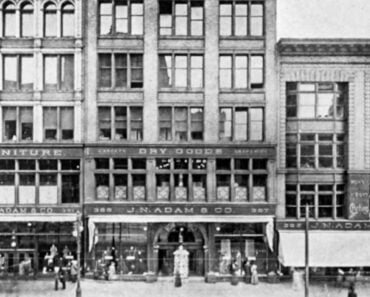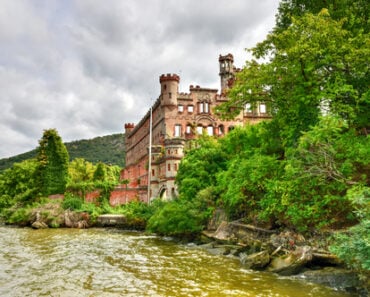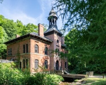
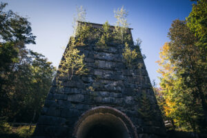
The abandoned MacIntyre Blast Furnace at Tahawus, one of the surviving landmarks of the Adirondacks’ historic iron-mining industry. Photo: Philip Mowbray / Shutterstock.com.
Across Upstate New York, the shifting tides of industry, infrastructure, and conservation have left behind quiet monuments to communities that once thrived. From deep within the Adirondacks to the river valleys of the Catskills and Western New York, mining camps, industrial settlements, and farming hamlets flourished in the 18th and 19th centuries, only to fade from the map.
Some of these settlements were abandoned when iron mines closed, tanneries lost their markets, or lumber operations moved elsewhere. Others were intentionally dismantled, cleared, and flooded during major engineering projects that created reservoirs for drinking water, canal operations, and flood control. Their histories are different, but all 16 were once real places where people lived and worked.
1. Tahawus (Village of Adirondac)
Location: Town of Newcomb, Essex County
In the Adirondack High Peaks region, iron deposits discovered in 1826 helped give rise to the remote mining village of Adirondac, also associated with the name Tahawus. Workers and their families lived near furnaces, workshops, a sawmill, and company buildings. Transporting iron out of the wilderness proved costly, and the original ironworks ceased production in the 1850s. The village became known as the Deserted Village, even as sporting clubs and travelers continued to visit the area.
The wider Tahawus property later saw another industrial chapter when titanium mining began in the 1940s. Those operations ended in the 1980s, but the remains of the original ironworks have gained new attention. The Open Space Institute acquired the tract in 2003 and preserved the historic core, including the MacNaughton Cottage and blast furnace. Visitors can follow interpretive trails through part of the former settlement.
2. Hammondville
Location: Town of Crown Point, Essex County
Hammondville grew around the Crown Point Iron Company’s operations in the Adirondack foothills near Lake Champlain. The company supplied housing, a store, a school, a church, and other services for workers and their families. Immigrants from Ireland, Quebec, Sweden, and England lived alongside American-born residents. At its height, it was an active mining community rather than the isolated ruins seen today.
Industrial and financial changes weakened the Crown Point Iron Company, and Hammondville was abandoned in the 1890s. After the company’s holdings changed hands, buildings and equipment were auctioned off around 1900. Much of the former village was dismantled piece by piece. Cellar holes, foundations, and other traces remain to document an Adirondack company town that disappeared when its principal employer failed.
3. Griffin
Location: Town of Wells area, Hamilton County
Along the East Branch of the Sacandaga River, Griffin was a prosperous tannery and lumber settlement during the late 19th century. Water from the river supported the Rice Emery tannery and the Morgan Lumber Company’s mills. The community had houses, farms, a school, a church, hotels, and a tavern. The Girard family operated a hotel that first served as lodging for lumber-company workers.
By the early 20th century, changes in tanning and the decline of local industry had taken away the jobs that supported Griffin. A brief attempt to attract hunters and other visitors could not replace the lost economy. Hamilton County historical accounts place the end of Griffin as a functioning community around the 1930s. Foundations, industrial remnants, and a few surviving structures still recall the once-busy settlement.
4. Benson Mines (Original Village)
Location: Town of Clifton, St. Lawrence County
The original village of Benson Mines grew alongside an Adirondack iron-mining operation near Star Lake. By the early 20th century, it had houses, hotels, railroad connections, and workers who depended on the mines. Its most unusual chapter came during World War II, when the Jones & Laughlin company expanded production and discovered that valuable ore continued beneath the village itself.
Rather than abandon the deposit, the company moved portions of the settlement to land near Star Lake. Some buildings were relocated and reassembled, while others were demolished. The mine remained an important regional employer until operations ended in 1978, but the original village site was largely erased decades earlier. Its story is not simply that a mine closed: an inhabited community was physically moved to reach the ore below it.
5. Shavertown
Location: Town of Andes, Delaware County
Shavertown stood in the East Branch valley of the Delaware River, where farming, lumbering, and small industries sustained local families. Houses, churches, businesses, and transportation connections made it a recognizable Catskill hamlet. During the 20th century, plans for New York City’s Pepacton Reservoir placed the community directly in the projected flood zone.
Properties were acquired, residents relocated, and the old hamlet was removed as the reservoir basin was prepared. Shavertown disappeared with Arena, Pepacton, and Union Grove. Pepacton Reservoir entered service in 1955. The Shavertown name survives on the modern bridge crossing the reservoir, but the original streets and homes are gone from the valley.
6. Delta
Location: Town of Western, Oneida County
The former village of Delta stood along the Mohawk River north of Rome, where mills, shops, farms, and homes formed a canal-era community. Its disappearance came not from New York City’s drinking-water system, but from the state’s effort to provide a reliable water supply for the expanded Barge Canal. Construction of Delta Dam required a new reservoir over the existing settlement.
New York State Senate historical records describe the removal of 295 buildings, including 70 houses, and the relocation of two cemeteries. Most buildings were moved or demolished before the water rose. The dam was completed in 1912, leaving the former village beneath Delta Reservoir. Delta Lake State Park now occupies land along the reservoir, but it is not the old village restored.
7. Conklingville (Old Settlement)
Location: Town of Hadley area, Saratoga County
Conklingville stood on the Sacandaga River near the place chosen for the dam that would form Great Sacandaga Lake. The river valley supported farms, mills, and small hamlets before the state moved ahead with a major flood-control project. The aim was to reduce destructive flooding downstream along the Sacandaga and Hudson rivers, especially after severe floods earlier in the century.
Construction of Conklingville Dam began in the 1920s. On March 27, 1930, the dam’s gates were closed and the reservoir began to fill. Homes, roads, farmland, and sections of several Sacandaga Valley communities were removed or flooded. The old settlement around Conklingville was substantially altered, although the name continues at the dam and in the surrounding area; it would be inaccurate to say that every part of modern Conklingville lies underwater.
8. Doodletown
Location: Town of Stony Point, Rockland County
Doodletown was an isolated Hudson Highlands hamlet whose history extended back to the 18th century. Generations of families lived among steep wooded hills near the Hudson River, making a living through farming, mining, timber work, and jobs elsewhere in the region. At its height, it had homes, churches, a school, and cemeteries. Unlike the drowned reservoir towns, Doodletown was not submerged.
The Palisades Interstate Park Commission gradually acquired the hamlet’s property as Bear Mountain State Park expanded. The last households left during the 1960s, and most buildings were removed. Today, abandoned roads, cellar holes, stonework, and family cemeteries make Doodletown one of New York’s most tangible former communities. The site is in the lower Hudson Valley, which some New Yorkers distinguish from Upstate New York.
9. Trapps Mountain Hamlet
Location: Town of Gardiner, Ulster County
High on the Shawangunk Ridge, families at the Trapps sustained themselves through small-scale agriculture, gathering huckleberries, charcoal production, stonework, and other labor suited to the mountains. The hamlet was well established by the 19th century; the Mohonk Preserve reports that 40 to 50 families lived there around the Civil War period. The settlement contained houses, mills, barns, a school, and burial grounds.
As transportation and employment changed, residents gradually left the ridge. The community did not vanish in a single dramatic event, and claims that its last resident died in the mid-1980s are not supported by the stronger historical record. Today the Mohonk Preserve protects the Trapps Mountain Hamlet Historic District, including many cellar holes, stone foundations, charcoal pits, and the restored Van Leuven Cabin.
10. Quaker Bridge (Former Town of Elko)
Location: Former Town of Elko, Cattaraugus County
Quaker Bridge was a river crossing and settlement along the Allegheny River in western New York. Seneca people had deep historical connections to this valley, and Quaker missions and later railroad lines were part of the area’s more recent history. Quaker Bridge became associated with the former Town of Elko, one of the communities that lay in the path of the Kinzua Dam reservoir.
The federal Kinzua Dam project, completed in 1965, flooded the old crossing and surrounding lowlands. The project also took land from the Seneca Nation’s Allegany Territory and displaced Seneca families despite longstanding treaty protections and strong opposition. Quaker Bridge disappeared from the riverbank, but the story cannot be understood solely as a deserted hamlet: it was also part of a profound loss of Indigenous land and community.
11. Onoville (Old River Settlement)
Location: Town of Coldspring, Cattaraugus County
Onoville developed along the Allegheny River as a river and railroad community. Timber operations, transportation, and local businesses supported families who lived along the valley. Historic railway records document a station and a route through Onoville, Wolf Run, and Quaker Bridge, tying these communities to the broader economic life of western New York.
The Kinzua Dam project changed the valley in the 1960s. Railroad service and earlier road alignments disappeared as the reservoir filled, and the old Onoville river settlement was lost. The name survives at Onoville Marina Park, a recreation area on the Allegheny Reservoir, but that modern marina should not be confused with the former inhabited village.
12. Happy Valley
Location: Towns of Albion and neighboring Oswego County towns
Happy Valley was part of a rural farming landscape on the western edge of the Tug Hill region. During the 19th century, families cleared land, built homesteads, and attempted to make a living from difficult, rocky soil. Harsh winters and limited agricultural returns were persistent obstacles, even before the economic hardships of the Great Depression.
Federal resettlement programs acquired farms from residents who wished to leave during the Depression era. Reforestation and wildlife-management work followed, with Civilian Conservation Corps and other crews planting trees and developing habitat. New York State eventually took permanent ownership of the area that is now Happy Valley Wildlife Management Area. Stone walls and other traces of former farms remain, but the surrounding landscape has become forest, fields, and wetlands.
13. Brown’s Station
Location: Town of Olive, Ulster County
Brown’s Station was a Catskill hamlet in the Esopus Creek valley, where the Ulster and Delaware Railroad connected farms, boarding houses, and local businesses with the wider region. Visitors came for the mountain setting, and the railroad helped sustain the area’s seasonal economy. The community became one of the places directly affected by construction of the Ashokan Reservoir.
Beginning in the early 20th century, New York City purchased property and cleared portions of the Esopus Valley for its Catskill water supply. Brown’s Station was removed and its former site became part of the Ashokan reservoir landscape. The reservoir entered service in 1915. Photographs preserved by the Olive Free Library and New York Heritage document life in the valley before the waters changed it.
14. Arena
Location: Town of Middletown, Delaware County
Arena was once a settled community along the East Branch of the Delaware River, known earlier as Lumberville. Lumbering, agriculture, local businesses, and eventually railroad connections shaped its economy. Shops and public buildings served families throughout the valley, making Arena more than a crossroads on the way to larger towns.
The community lay within the land acquired for the Pepacton Reservoir. As the 1950s approached, residents were displaced and buildings cleared to prepare the basin. Arena disappeared along with Shavertown, Pepacton, and Union Grove. Its name remains in historical photographs and records, but the settlement itself was eliminated by the reservoir that began operating in 1955.
15. Eureka
Location: Town of Neversink, Sullivan County
Eureka was one of the small Catskill communities along Rondout Creek before New York City built Rondout Reservoir. Its farms and homes formed part of a rural landscape shared with nearby Montela and Lackawack. Like other communities in the watershed, Eureka had a largely local, agricultural history rather than one built around a large factory or mine.
The Rondout Reservoir project required clearing the valley in the mid-20th century. Eureka, along with neighboring settlements, was eliminated as the city developed a central collecting reservoir for its Delaware water-supply system. The Catskill Watershed Corporation and the Town of Neversink both identify Eureka among the communities lost in this transformation.
16. Lackawack
Location: Town of Wawarsing, Ulster County
Lackawack was another settled place along Rondout Creek, west of the better-known Catskill tourist communities. Homes and farms occupied a valley that later became crucial to New York City’s water supply. Although it was smaller than many towns elsewhere in the state, Lackawack was a lived-in community with families whose property and local connections were rooted in the area.
The construction of Rondout Reservoir displaced those residents and eliminated the old hamlet. The reservoir went into service around 1950 as a major component of the Delaware water-supply system. The former Lackawack area is now part of the reservoir landscape. It is one of the clearest examples of a hamlet whose name survives in local history even though its original community no longer exists.
Upstate New York’s lost communities disappeared for different reasons. Some were gradually emptied by changes in industry and farming; others were cleared in a matter of years to make room for reservoirs. The surviving ruins, historical photographs, records, and place names offer a reminder that many apparently empty landscapes were once home to entire neighborhoods and generations of families.
For more New York history, read our articles on submerged and vanished Upstate New York communities, abandoned places in Upstate New York, and haunted places with real historical backgrounds.