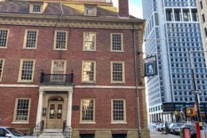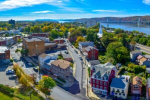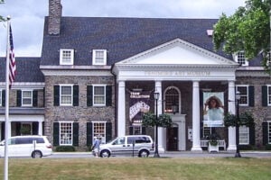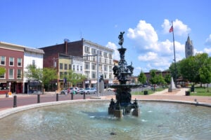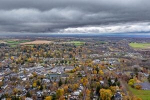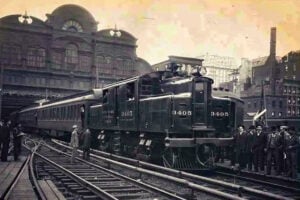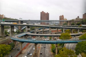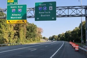
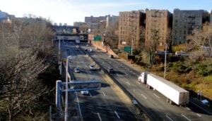
The Cross Bronx Expressway cut directly through established Bronx neighborhoods, displacing residents and permanently altering communities such as East Tremont. Photo by quiggyt4 / Shutterstock.com
New York City has always reinvented itself, but some of that reinvention came at the cost of entire communities. Beneath Central Park, Lincoln Center, the World Trade Center, modern apartment complexes, and familiar street grids are traces of neighborhoods that once had their own homes, businesses, churches, schools, clubs, newspapers, and identities.
Some were demolished through eminent domain or urban renewal. Others were absorbed into larger neighborhoods as streets were extended, populations moved, or the city’s economy changed around them. These 10 lost New York neighborhoods and communities once appeared on maps, in newspapers, and in the everyday vocabulary of generations of New Yorkers before their names largely disappeared.
1. Seneca Village
Location: Inside what is now Central Park, near West 82nd to West 89th Streets
Active Era: 1825–1857
Seneca Village was one of the most significant communities to disappear during the creation of Central Park. Free Black New Yorkers began purchasing land there in 1825, at a time when property ownership could help Black men satisfy New York’s restrictive voting requirements.
By 1855, the village had approximately 225 residents, roughly two-thirds Black and one-third Irish, along with three churches, a school, homes, gardens, barns, and other structures. The community stood far north of the city’s densely developed downtown neighborhoods and offered many of its residents a degree of independence that was difficult to find elsewhere in Manhattan.
How It Disappeared: New York City acquired the land for Central Park through eminent domain. Residents were compensated according to the condemnation process, although some challenged the valuations placed on their property. The remaining residents had left by 1857, and construction of the park began soon afterward.
What’s There Today: Central Park. The area associated with Seneca Village lies along the western side of the park near West 85th Street, and archaeological and historical research continues to recover the story of the community.
2. Little Syria
Location: Washington Street and the surrounding blocks of Lower Manhattan
Active Era: Late 19th century through the mid-20th century
Long before Arab American communities flourished elsewhere in New York, Lower Manhattan was home to a neighborhood commonly called Little Syria. Immigrants from regions that are today part of Lebanon, Syria, Palestine, and neighboring areas settled around Washington Street and built a dense network of stores, restaurants, importing businesses, churches, newspapers, and publishing houses.
The neighborhood became one of the most important early centers of Arab American cultural life in the United States. Writer and artist Kahlil Gibran was part of the literary world connected to Little Syria, and Arabic-language publishing helped make the district an intellectual center as well as a commercial one.
How It Disappeared: Major sections of the neighborhood were demolished in the 1940s for construction associated with the Brooklyn-Battery Tunnel. Additional displacement followed when the World Trade Center superblock transformed the surrounding Lower Manhattan street network in the 1960s.
What’s There Today: The tunnel approaches, office towers, and the modern Financial District dominate the area. A small number of historic Washington Street buildings survive as reminders of the old community.
3. San Juan Hill
Location: Roughly West 57th to West 65th Streets, west of Amsterdam Avenue toward the Hudson River
Active Era: Late 19th century through the 1950s
San Juan Hill was a densely populated, largely working-class neighborhood with an extraordinary African American and Afro-Caribbean cultural life. Its theaters, dance halls, clubs, churches, businesses, and gathering places made it an important center of Black New York before Harlem became internationally famous.
The neighborhood’s musical legacy was enormous. James P. Johnson, one of the architects of stride piano, worked in the area’s clubs, while Thelonious Monk grew up nearby. San Juan Hill also contributed to the development of jazz, bebop, ragtime, mambo, and the dance culture that helped turn the Charleston into an international phenomenon.
How It Disappeared: In the 1950s, San Juan Hill and the broader Lincoln Square area were targeted for urban renewal. More than 7,000 families and approximately 800 businesses were displaced as hundreds of buildings were demolished and the old street fabric was replaced by superblocks.
What’s There Today: Lincoln Center for the Performing Arts, Fordham University’s Lincoln Center campus, Lincoln Towers, Amsterdam Houses, and other developments occupy much of the area once associated with San Juan Hill.
4. Five Points
Location: Around the former intersection of Orange, Anthony, and Cross Streets, now roughly Baxter, Worth, and Mosco Streets in Lower Manhattan
Active Era: Early to late 19th century
Five Points grew near the filled-in Collect Pond and became one of the most famous and infamous neighborhoods in 19th-century America. Its unusual street pattern created a five-way intersection that gave the district its name.
Poor Irish immigrants, free Black New Yorkers, and later other immigrant groups lived in the crowded neighborhood. Five Points developed a reputation for poverty, crime, political corruption, and terrible housing conditions, but it was also a place of cultural exchange. Dance halls and saloons brought African American and Irish traditions into contact with one another, contributing to the development of American popular dance.
How It Disappeared: Five Points did not vanish in a single demolition campaign. Street changes, tenement reform, the clearing of notorious housing such as Mulberry Bend, new parks, civic construction, and later redevelopment gradually erased the neighborhood’s physical form and identity.
What’s There Today: Columbus Park, Chinatown, the Manhattan Civic Center, courthouses, and federal buildings occupy much of the former Five Points area.
5. Radio Row
Location: Lower Manhattan, centered on Cortlandt, Dey, Greenwich, and nearby streets
Active Era: 1920s–1960s
Radio Row was one of New York’s great specialized business districts. Hundreds of stores sold radios, vacuum tubes, electronic components, television equipment, surplus parts, and machinery to everyone from professional engineers to teenage hobbyists.
At its peak, the district had more than 300 businesses and employed tens of thousands of people. Its crowded storefronts and signs gave the streets west of Broadway a distinctive identity unlike anywhere else in the city.
How It Disappeared: In 1962, New York and New Jersey authorized the Port Authority to build the World Trade Center on the west side of Lower Manhattan. Radio Row merchants fought the project in court, but their appeal was ultimately unsuccessful. The district was acquired through eminent domain and razed for the World Trade Center superblock.
What’s There Today: The World Trade Center complex, the 9/11 Memorial, and the Oculus Transportation Hub.
6. Weeksville
Location: Present-day Crown Heights and Bedford-Stuyvesant, Brooklyn
Active Era: Founded in 1838; gradually absorbed into urban Brooklyn
Weeksville was an independent free Black community founded in 1838 and named for James Weeks, a Black stevedore who purchased property in the area. Land ownership offered African American New Yorkers economic independence and political opportunities at a time when the state placed discriminatory property requirements on Black male voters.
The community grew into one of the largest independent African American settlements in the United States before the Civil War. Weeksville developed churches, schools, businesses, charitable institutions, and its own newspaper culture, becoming an important refuge and center of Black civic life.
How It Disappeared: Brooklyn’s expanding street grid and rapid urbanization gradually absorbed Weeksville into the surrounding city. Roads disappeared, buildings were demolished or replaced, and even the community’s name largely vanished from everyday use.
What’s There Today: Crown Heights and Bedford-Stuyvesant occupy the broader area. The Weeksville Heritage Center preserves the Historic Hunterfly Road Houses and the memory of the community after local activists rediscovered surviving structures in 1968.
7. The Gashouse District
Location: Manhattan’s East Side, roughly East 14th to East 23rd Streets from First Avenue toward the East River
Active Era: Mid-19th century through the 1940s
The Gashouse District took its name from the enormous gas-storage tanks that began appearing on Manhattan’s East Side in the 1840s. The tanks and industrial facilities gave the area an unmistakable smell and helped make nearby housing inexpensive, attracting successive generations of working-class and immigrant New Yorkers.
It was a hard-edged neighborhood of tenements, factories, churches, theaters, stores, and street life. The district also developed a notorious underworld reputation that became part of New York gang folklore.
How It Disappeared: By the 1940s, large-scale redevelopment transformed the East Side. Thousands of residents were relocated and hundreds of tenement buildings were demolished as Metropolitan Life created Stuyvesant Town and Peter Cooper Village. Construction of the FDR Drive and the decline of the old gas infrastructure further changed the district.
What’s There Today: Stuyvesant Town-Peter Cooper Village and the surrounding East Side residential blocks occupy much of the former Gashouse District.
8. Little Africa
Location: Greenwich Village and the South Village, centered around Minetta Street, Minetta Lane, and surrounding streets
Active Era: 19th century into the early 20th century
Before Harlem and before San Juan Hill, Greenwich Village contained one of New York’s most important Black communities. The area around Minetta Lane and Minetta Street became known as Little Africa and was home to Black-owned businesses, churches, schools, theaters, and civic institutions.
At its height, the broader Black community in this part of downtown Manhattan numbered in the thousands. It included abolitionists, ministers, entrepreneurs, workers, artists, and families whose institutions helped establish a foundation for Black political and cultural life in New York.
How It Disappeared: By the end of the 19th century and the opening decades of the 20th, many Black residents moved north to other Manhattan neighborhoods as European immigration changed the South Village and new housing opportunities opened elsewhere. Construction projects also erased pieces of the old neighborhood, including buildings lost during the extension of Sixth Avenue.
What’s There Today: Greenwich Village and the South Village. Minetta Street and Minetta Lane still preserve the geography of the old district, although Little Africa no longer survives as a distinct neighborhood.
9. Kleindeutschland, or Little Germany
Location: The Lower East Side, particularly around today’s East Village and eastern Lower Manhattan
Active Era: Mid-19th century through the opening years of the 20th century
During the 19th century, German immigration transformed the Lower East Side into Kleindeutschland, or Little Germany. German-language newspapers, churches, schools, beer gardens, social clubs, shops, bakeries, and hundreds of saloons gave the neighborhood a cultural identity so strong that it functioned almost like a German city within New York.
By 1870, German-speaking immigrants made up an enormous portion of the population in the area. Families from different German states built organizations around their regional identities while also developing a broader German American culture.
How It Disappeared: By the late 19th century, the neighborhood was already changing as successful German families moved to Yorkville and other areas and new waves of Jewish and Italian immigrants arrived. The 1904 General Slocum disaster, which killed more than 1,000 people from the German community, accelerated an existing migration away from the Lower East Side.
What’s There Today: The East Village and Lower East Side. Institutions such as the Tenement Museum preserve the history of the German families and businesses that once defined Kleindeutschland.
10. East Tremont and the Communities Destroyed by the Cross Bronx Expressway
Location: The Bronx, particularly East Tremont, Morris Heights, and neighborhoods along the Cross Bronx Expressway corridor
Active Era: Established neighborhoods before the major highway clearances of the 1950s and 1960s
No discussion of New York communities destroyed by redevelopment would be complete without recognizing what happened in the Bronx during construction of the Cross Bronx Expressway. This one hits me hard because I am from the Bronx. Robert Moses drove the massive highway project through established residential neighborhoods, cutting a trench across the borough and permanently changing communities that generations of Bronx families had called home.
East Tremont became the most famous battleground. It was a stable working-class neighborhood of apartment houses, stores, synagogues, churches, schools, and tightly connected families. Residents organized against the proposed route and argued that the highway could be shifted nearby with far less destruction. Their campaign failed.
The routing fight began before Robert F. Wagner Jr. became mayor in 1954, during the administration of Vincent R. Impellitteri, but major construction and the continuing political struggle unfolded during Wagner’s years at City Hall. Throughout that period, Moses remained the dominant force behind the expressway project.
How It Was Destroyed: Construction of the Cross Bronx Expressway required enormous amounts of demolition across the borough. New York City now estimates that approximately 40,000 residents were directly displaced by the highway. In East Tremont, apartment blocks were condemned and families were forced from a community that residents had fought desperately to preserve. The damage did not end with the demolitions. The expressway divided neighborhoods, isolated local streets and businesses, generated noise and pollution, and became one of the forces associated with the Bronx’s postwar population and economic decline.
The contrast with Manhattan became one of the defining stories of Robert Moses’s era. Moses also championed the proposed Lower Manhattan Expressway, a massive highway that would have cut across Lower Manhattan through areas including today’s SoHo and Little Italy. There, Jane Jacobs and a powerful coalition of residents, business owners, and neighborhood activists fought the project. In 1962, the Board of Estimate rejected the necessary appropriation, helping stop a highway that New York City later estimated would have displaced nearly 2,000 families.
The Bronx did not receive the same outcome. Residents along the Cross Bronx fought, protested, organized, and proposed alternatives, but the road was built through their communities.
What’s There Today: The Cross Bronx Expressway remains one of the busiest and most consequential highways in New York City. It’s practically a parking lot. East Tremont, Morris Heights, and the other neighborhoods along its route still exist, but their physical landscapes bear the unmistakable scar of the roadway. Current city and state plans are examining ways to reconnect communities divided by the expressway and reduce the health, environmental, and economic damage that has persisted for more than six decades.
Sources
Central Park Conservancy: Seneca Village History
New York City Public Schools: Arab American Heritage Month and Little Syria
Lincoln Center: Legacies of San Juan Hill
Museum of the City of New York: Five Points and the Unplanned City
Library of Congress: Jacob Riis, Tenement Reform, and Five Points
National September 11 Memorial & Museum: Radio Row and the World Trade Center Site
Weeksville Heritage Center: Collections and Research
Museum of the City of New York: Forgotten Villages and Neighborhoods of Manhattan
Village Preservation: Little Africa and Black History in the South Village
Tenement Museum: The Decline and Fall of Kleindeutschland
New York City Mayor’s Office: History and Community Impact of the Cross Bronx Expressway
New York City Department of Transportation: Reimagine the Cross Bronx Final Report
New York City Comptroller: New York’s Diverse and Evolving Neighborhoods
New York City Council: Jane Jacobs and the Fight Against the Lower Manhattan Expressway
More New York Neighborhood History
New York’s vanished communities are part of the larger story of how the city’s neighborhoods have continually changed. For more, read our guide to the 10 Oldest Neighborhoods in New York City, the History of New York’s Central Park, and our look at Lincoln Center.
Updated August 19, 2026.