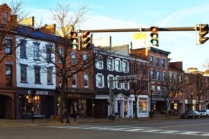
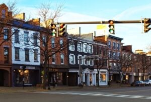
U.S. Route 20 runs directly through the heart of Skaneateles along East Genesee Street. Photo: debra millet / Shutterstock.com
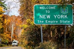
For millions of downstate New Yorkers, traveling across upstate New York means one thing: the New York State Thruway (Interstate 90). It is an efficient ribbon of limited-access highway engineered to move vehicles quickly past green distance signs, sound barriers, interchanges, and service areas. Yet running roughly parallel for much of the journey, often miles to the south, lies an entirely different world: United States Route 20. Stretching about 372 miles across New York from the Massachusetts state line at New Lebanon to the Pennsylvania border at Ripley, Route 20 is not merely an alternative drive. It is one of the foundational overland corridors of New York State. Before the Thruway redirected long-distance traffic in the 1950s, Route 20 served as one of the state’s great east-west roads, tying together cities, villages, farms, commercial centers, and routes leading toward the American frontier.
From Ancient Native Trails to the Great Western Turnpike
The path that became Route 20 was not conceived on an engineer’s drafting table. Parts of the corridor developed from Native American footpaths used by Haudenosaunee peoples long before European settlement. The Mohawk, Oneida, Onondaga, Cayuga, and Seneca nations formed the original Five Nations of the Haudenosaunee Confederacy, later joined by the Tuscarora. Across central New York, Native trails connected settlements, river valleys, hunting grounds, and inland waterways, and portions of those older travel corridors later influenced colonial and early American roads.
Following the American Revolution, as settlers pushed westward, New York recognized the need for better overland transportation. In 1799, the state chartered the First Great Western Turnpike Corporation to build a toll road from Albany west to Cherry Valley. That road was completed by 1801. In 1803, the Third Great Western Turnpike Corporation was chartered to extend the route farther west toward Cazenovia, a section completed by 1811. Together, these roads became closely associated with the Cherry Valley Turnpike. Toll gates stood at intervals along the route, while freight wagons, cattle drovers, stagecoach teams, and settlers moved across the ridges of Central New York. The corridor helped drive westward settlement years before the Erie Canal opened in 1825.
The Golden Age of Stagecoaches and Taverns
Throughout the early nineteenth century, travel along the turnpike was measured not in miles per hour, but in the distance a team of horses could cover between stops. The road functioned as a busy stagecoach corridor, and inns, taverns, and stables appeared along the route to serve travelers and their animals. These establishments also became gathering places where residents and travelers exchanged news, conducted business, and learned what was happening beyond their own communities.
Some of that stagecoach history survives today. The Sherwood Inn in Skaneateles traces its beginnings to 1807, when Isaac Sherwood established a tavern connected to his stagecoach business. In Cazenovia, the Lincklaen House was built in 1835 and opened in 1836, with stagecoach teams stopping outside the hotel. Old toll-gate sites, historic roadside markers, and surviving portions of earlier alignments still provide physical reminders of the era when crossing New York took days rather than hours.
Where Route 20 Runs Across New York
Covering roughly 372 miles across the Empire State, U.S. Route 20 passes through 17 New York counties and crosses some of the state’s most distinctive landscapes. Traveling west from New England, the highway unfolds across several very different regions.
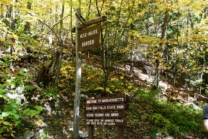
The Taconic Foothills and Capital District: Entering New York at New Lebanon, Route 20 crosses Columbia and Rensselaer counties, passing through Nassau and East Greenbush before crossing the Hudson River on the Dunn Memorial Bridge into Albany. The road enters a capital city whose growth was shaped by the Hudson River, turnpikes, railroads, and the eastern terminus of the Erie Canal.
The Capital Region and Schoharie Hill Country: Leaving Albany, Route 20 travels through Guilderland and Duanesburg before crossing the rolling uplands of Schoharie County through communities such as Esperance, Sloansville, and Sharon Springs. From the higher ground, the road offers broad views toward the Mohawk Valley and the distant Adirondack foothills.
The Leatherstocking Region and Central New York: Route 20 continues across Otsego, Herkimer, Oneida, Madison, and Onondaga counties through a landscape closely tied to the old Cherry Valley Turnpike. The modern highway passes north of the historic village of Cherry Valley, while the older alignment can still be followed as a historic excursion. The route continues through the Richfield Springs area, Bridgewater, Sangerfield, Bouckville, Cazenovia, Pompey, and LaFayette, crossing some of the most dramatic hill country on the entire New York route.
The Glacial Finger Lakes: Descending toward the Finger Lakes, Route 20 becomes the main street of a remarkable succession of communities. It runs through Skaneateles and Auburn, continues across the northern Finger Lakes corridor through Seneca Falls and Waterloo, reaches the lakefront in Geneva, and then heads west toward Canandaigua. Along this portion, Route 20 shares the roadway with New York State Route 5 for many miles.
The Genesee Valley and Western Farmlands: West of Canandaigua, the highway crosses Ontario and Livingston counties, passes through the historic traffic circle at Avon, and continues across the Genesee Valley. In Genesee County, Route 20 runs through communities including Alexander and passes south of the city of Batavia rather than through its downtown.
The Lake Erie Grape Belt: Farther west, Route 20 crosses Erie County through Alden, Depew, and the Buffalo suburbs before reaching Hamburg and turning toward the Lake Erie corridor. It then continues through Silver Creek, Fredonia, Westfield, and Ripley before entering Pennsylvania. This western stretch passes through one of New York’s historic grape-growing regions, where vineyards spread across the Lake Erie plain.
The Mid-Century Roadside Era: Diners, Drive-Ins, and Neon
With the creation of the U.S. numbered highway system in 1926, the older roads and turnpikes were incorporated into what became U.S. Route 20. The highway entered another golden age during the automobile era of the 1930s, 1940s, and early 1950s, when it carried vacationers, commercial traffic, local residents, and long-distance travelers across New York.
Independent businesses grew along the pavement to serve them. Diners, tourist cabins, motor courts, gas stations, custard stands, farm markets, roadside attractions, and drive-in theaters became part of the Route 20 landscape. Driving across New York meant stopping for coffee at roadside diners, buying produce from farm stands, and spending the night at family-run motels where the owners often lived only a few steps from the office.
The Great Thruway Bypass and the Preservation Paradox
The automobile era along Route 20 changed dramatically after the New York State Thruway began opening in the 1950s. On June 24, 1954, the first toll section opened along a 115-mile stretch between Lowell and Rochester. The Rochester-to-Buffalo section followed in August, and the Utica-to-Newburgh section opened in October. As the controlled-access highway expanded, much of the long-distance passenger and commercial traffic that once depended on roads such as Route 20 shifted to the Thruway.
Businesses that relied heavily on passing motorists felt the change. Some gas stations, roadside attractions, motor courts, and restaurants disappeared as traffic patterns shifted. Yet the effect created a historical paradox in many communities. Town centers that were no longer carrying the same volume of long-distance traffic often retained a surprising amount of their older built environment. Nineteenth-century storefronts, Federal and Greek Revival homes, old inns, village greens, and pieces of mid-century roadside architecture remained visible along the corridor, even as development continued elsewhere.
That historic character eventually became part of Route 20’s modern identity. In 2006, a 108-mile section of U.S. Route 20 between Duanesburg in Schenectady County and LaFayette in Onondaga County was designated the Route 20 Scenic Byway by New York State. The designation applies to that Central New York section rather than the entire 372-mile route across the state.
What Downstate Travelers Need to Know Today
For travelers venturing north from Long Island, New York City, or Westchester, stepping off the Thruway and onto Route 20 provides an entirely different way to see the state. Unlike interstate travel, Route 20 offers a slower, more human-scale experience in which the road itself remains part of the destination.
Authentic Architecture: The route preserves a remarkable cross-section of New York architecture, including early farmhouses, Shaker sites, Greek Revival buildings, nineteenth-century hotels, village commercial blocks, and surviving examples of twentieth-century roadside design.
Direct Downtown Access: Route 20 does not simply bypass every small town. In many communities, it still functions as Main Street. Drivers can pull into village centers, walk to shops and restaurants, visit historic sites, and experience places that disappear almost completely from view when traveling by interstate.
The Nation’s Longest Highway: Route 20 holds a national distinction far beyond New York. The Federal Highway Administration identifies U.S. 20 as the longest road in the United States, stretching 3,365 miles from Boston, Massachusetts, to Newport, Oregon. The U.S. 20 designation is interrupted through Yellowstone National Park, where U.S. highway numbers are not posted, but the route continues on the other side. Driving Route 20 across New York means traveling one of the most historically important segments of that coast-to-coast highway.
Route 20 remains a living monument to the way New York and the nation were built. It is a road that asks travelers to trade interstate speed for substance, offering a journey through old turnpike country, village main streets, Finger Lakes communities, western farmland, and the Lake Erie grape belt. For anyone willing to leave the Thruway behind for a while, Route 20 still reveals a version of New York that the interstate was never designed to show.
For more on the roads, rails, and regions that shaped travel across the Empire State, read our look at where Upstate New York begins, the history of New York’s Empire State Express train, and our visit to the New York State Thruway rest stops.
Sources
New York State Department of Transportation — Route Twenty Scenic Byway
New York State Library — Great Western Turnpike Company Records
New York State Thruway Authority — History of the NYS Thruway
Federal Highway Administration — What Is the Longest Road in the United States?