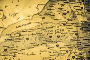
A map of New York State showing many of the cities and geographic areas that help define the state’s distinct regions. Photo by Alexander Lukatskiy / Shutterstock.com.
Few questions expose New York’s regional loyalties faster than asking where Upstate begins. Someone in New York City may casually use the word for almost anything north of the Bronx. Someone in Westchester may push the line much farther north. A resident of Albany, Syracuse, Rochester, Buffalo, or Plattsburgh may hear those answers and wonder how the Hudson Valley became part of the argument at all.
The disagreement exists for a good reason: New York State does not have one universal boundary separating Upstate from Downstate, nor does every state agency divide the regions in the same way. Economic development, transportation, health care, tourism, payroll, and environmental agencies all use regional maps designed for different purposes. That means a county can be considered Mid-Hudson on one official map, Downstate for a particular state program, and part of the Hudson Valley on another.
This article takes a different approach. Rather than pretending there is one line that every New Yorker must accept, it explains why the definitions vary and then establishes a clear county-by-county framework for understanding New York State. For regional classification, the most useful statewide starting point is the ten-region system used by New York’s Regional Economic Development Councils. From there, cultural and geographic regions such as the Hudson Valley, Catskills, and Adirondacks can be understood as important overlays rather than competing maps.
The First Rule: There Is No Single Official Upstate Line
The most important fact in the entire debate is that “Upstate” and “Downstate” are not defined by one universal New York State law. Different government programs draw the line differently. One New York State Department of Health regulation defines Downstate as New York City, Nassau, Suffolk, and Westchester, while treating Dutchess, Orange, Putnam, Rockland, Sullivan, and Ulster as a separate Hudson Valley region. Another Department of Health regulation uses a broader Downstate definition that includes New York City, Nassau, Suffolk, Westchester, Rockland, Orange, Putnam, and Dutchess.
New York State Civil Service provides another example. For certain state employee pay adjustments, the Downstate area includes New York City, Nassau, Suffolk, Rockland, and Westchester, while Dutchess, Orange, and Putnam receive a separate Mid-Hudson adjustment. The point is not that one of these definitions is right and the others are wrong. The point is that the boundary changes according to what the state is trying to administer.
That is why arguments about the exact place where Upstate begins never truly end. The term is partly geographic, partly economic, partly cultural, and partly a matter of where the person using it happens to live.
The County Map Used for This Guide
For a consistent county-by-county reference, this article uses the ten regions established by New York State’s Regional Economic Development Councils: New York City, Long Island, Mid-Hudson, Capital Region, North Country, Mohawk Valley, Central New York, Finger Lakes, Southern Tier, and Western New York. This system assigns every one of New York State’s sixty-two counties to one region and provides a clean framework for locating cities, towns, and counties without pretending that cultural identities always stop at a county line.
This is not the only official map. The New York State Department of Transportation uses eleven regions with different county groupings, while I LOVE NY tourism divides the state into eleven vacation regions that include names such as the Adirondacks, Catskills, Greater Niagara, and Thousand Islands-Seaway. Those differences are useful because they show that New York’s regions can be defined by government administration, travel patterns, landscapes, history, or culture.
New York City and Long Island: The Clearest Boundaries
New York City is the easiest region to define administratively. It consists of five boroughs and five corresponding counties: Manhattan in New York County, Brooklyn in Kings County, Queens in Queens County, the Bronx in Bronx County, and Staten Island in Richmond County.
Long Island creates one important geographic wrinkle. Brooklyn and Queens are physically located on the landmass of Long Island, but in ordinary regional usage and in New York State’s economic development system, “Long Island” means Nassau and Suffolk counties. Brooklyn and Queens are classified as New York City. For regional discussions on ClassicNewYorkHistory.com, Long Island therefore means Nassau and Suffolk unless the physical geography of the island itself is specifically being discussed.
New York City and Nassau and Suffolk counties form the core of what almost everyone agrees is Downstate New York. The real argument begins immediately to their north.
Westchester, Rockland, and the Lower Hudson Valley
Westchester and Rockland counties sit at the heart of the Upstate versus Downstate argument. Both are part of the state’s Mid-Hudson economic development region, yet both are also deeply connected to the New York City metropolitan economy. Westchester directly borders the Bronx. Rockland sits across the Hudson from Westchester, and both counties are included in the Downstate adjustment used for many New York State employees.
For that reason, calling Westchester or Rockland simply “Upstate” can obscure more than it explains. They are better understood as the lower end of the Hudson Valley and part of the broader Downstate metropolitan orbit. White Plains, Yonkers, New Rochelle, Mount Vernon, Nyack, and the surrounding communities are connected economically and culturally to New York City in ways that differ sharply from Albany, Syracuse, Rochester, or Buffalo.
The Mid-Hudson Region: New York’s Great Transition Zone
The official Mid-Hudson economic development region contains seven counties: Dutchess, Orange, Putnam, Rockland, Sullivan, Ulster, and Westchester. This is the region where the simple Upstate-Downstate split becomes least useful.
Putnam, Orange, and Dutchess counties still maintain strong commuter and transportation ties to New York City. Metro-North serves communities in this broader corridor, and Poughkeepsie is the northern terminus of the Hudson Line. Yet as travelers move north through the Hudson Highlands and farther into Dutchess, Ulster, Sullivan, and Orange counties, the landscape increasingly changes from dense suburban development to smaller cities, villages, farms, river towns, mountain communities, and open land.
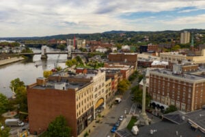
Poughkeepsie, Newburgh, Kingston, Beacon, Middletown, and Monticello are therefore best described first by their Hudson Valley or Mid-Hudson identity rather than being forced into a binary argument over whether they are Upstate or Downstate. In everyday speech, many New Yorkers will call some or all of this territory Upstate. Others will not. Both usages exist.
The Capital Region
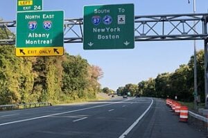
New York State’s Capital Region contains Albany, Columbia, Greene, Rensselaer, Saratoga, Schenectady, Warren, and Washington counties. Albany, Troy, Schenectady, and Saratoga Springs form the region’s principal urban and cultural anchors.
This is also where regional labels begin to overlap visibly. Columbia and Greene counties are strongly associated with the Hudson Valley, while Greene County also reaches into the Catskills. Warren County includes Lake George and substantial Adirondack territory. Saratoga County connects the Capital Region with the southern Adirondack corridor. On the economic development map, however, all eight counties belong to the Capital Region.
Unlike the disputed counties closer to New York City, Albany and the surrounding Capital Region are unambiguously Upstate in ordinary statewide usage.
The North Country
The North Country economic development region includes Clinton, Essex, Franklin, Hamilton, Jefferson, Lewis, and St. Lawrence counties. It reaches from Lake Champlain and the Canadian border west toward the St. Lawrence River and the eastern shore of Lake Ontario.
Plattsburgh anchors the Champlain Valley near the Canadian border. Watertown serves as an important commercial and military center near Fort Drum and the Thousand Islands. Much of the Adirondack Park lies within the North Country, although the park itself crosses into counties that belong to other economic regions.
The North Country is one of the clearest examples of why “Upstate” is too broad to function as a complete regional identity. Plattsburgh, Lake Placid, Watertown, and Potsdam are all Upstate, but their geography and history differ substantially from the Finger Lakes, Southern Tier, or Buffalo region.
The Mohawk Valley
The Mohawk Valley region consists of Fulton, Herkimer, Montgomery, Oneida, Otsego, and Schoharie counties. The Mohawk River and the historic Erie Canal corridor shaped much of the region’s development, particularly from Amsterdam through Little Falls, Utica, and Rome.
Utica and Rome are the principal cities of the eastern and central Mohawk Valley, while Amsterdam anchors the region farther east. Cooperstown in Otsego County belongs to the Mohawk Valley on the state’s economic development map, even though tourism maps and everyday travel discussions may group Cooperstown differently.
This is another example of why precise regional names are more useful than simply saying Upstate. Utica is Upstate, but “Mohawk Valley” tells the reader considerably more.
Central New York
Central New York contains Cayuga, Cortland, Madison, Onondaga, and Oswego counties under the state’s economic development framework. Syracuse is its dominant metropolitan center and one of the major crossroads of Upstate New York.
The region connects the Erie Canal corridor, the eastern Finger Lakes, Lake Ontario, and the north-south route toward the Pennsylvania border. Syracuse’s position at the junction of Interstate 81 and the New York State Thruway reinforces its long-standing role as a transportation center.
Oneida and Herkimer counties are sometimes casually included in broader definitions of Central New York, particularly in media or cultural usage, but the state’s economic development map places them in the Mohawk Valley. For this guide, Syracuse is Central New York; Utica and Rome are Mohawk Valley.
The Finger Lakes
The Finger Lakes economic development region consists of Genesee, Livingston, Monroe, Ontario, Orleans, Seneca, Wayne, Wyoming, and Yates counties. Rochester is the region’s largest city and economic anchor.
This placement matters because Rochester is sometimes casually described as Western New York. Culturally, Rochester certainly shares characteristics with the western part of the state, and it lies in western Upstate New York. Under the state’s ten-region economic development system, however, Rochester and Monroe County belong to the Finger Lakes region, not Western New York.
The same distinction applies to Genesee, Orleans, and Wyoming counties. They may feel western geographically, but they are assigned to the Finger Lakes region in the statewide economic development framework.
The Southern Tier
The Southern Tier region includes Broome, Chemung, Chenango, Delaware, Schuyler, Steuben, Tioga, and Tompkins counties. It follows much of New York’s southern border with Pennsylvania and includes Binghamton, Elmira, Corning, and Ithaca as major population and institutional centers.
The Southern Tier demonstrates how strongly cultural geography can overlap official boundaries. Ithaca and Tompkins County are closely identified with the Finger Lakes in tourism and everyday geography because Cayuga Lake dominates the landscape. The state’s economic development system nevertheless places Tompkins County in the Southern Tier. Delaware County also overlaps culturally with the Catskills.
These are not contradictions. They are reminders that a tourism region, a mountain region, and an economic region are answering different questions.
Western New York
Western New York contains Allegany, Cattaraugus, Chautauqua, Erie, and Niagara counties under the Regional Economic Development Council system. Buffalo is the region’s dominant city, while Niagara Falls, Jamestown, Olean, Dunkirk, and Lockport are among its other important population centers.
Buffalo and Niagara Falls are firmly Western New York. The region’s historical identity is tied to Lake Erie, the Niagara River, the western terminus of the Erie Canal, heavy industry, Great Lakes shipping, hydroelectric power, and the international border with Canada.
This official definition is narrower than some everyday uses of “Western New York.” Rochester is not included; neither are Genesee, Orleans, or Wyoming counties. Those counties belong to the Finger Lakes region on the state’s economic development map.
The Catskills and Adirondacks Do Not Follow the Same Borders
The Catskills and Adirondacks deserve special treatment because they are physical and cultural regions rather than simple economic development districts. Their boundaries cut across several of the county groups described above.
The Adirondack Park extends into all or portions of twelve counties: Clinton, Essex, Franklin, Fulton, Hamilton, Herkimer, Lewis, Oneida, Saratoga, St. Lawrence, Warren, and Washington. Those counties fall across the North Country, Mohawk Valley, and Capital Region economic maps. A place can therefore be both in the Adirondacks and in the Capital Region, or both in the Adirondacks and in the Mohawk Valley.
The Catskill Park crosses portions of Delaware, Greene, Schoharie, Sullivan, and Ulster counties. Those counties are divided among the Southern Tier, Capital Region, Mohawk Valley, and Mid-Hudson economic regions. That is why Woodstock can be described as both a Catskills community and a Mid-Hudson location, while parts of Greene County can be both Catskills and Capital Region.
So Where Does Upstate New York Actually Begin?
There is no single answer that works in every governmental, cultural, and geographic context. The clearest conclusion is that New York City and Long Island form the undisputed core of Downstate. Westchester and Rockland belong to the lower Hudson Valley and remain strongly tied to the Downstate metropolitan region. Putnam, Orange, Dutchess, Ulster, Sullivan, and the rest of the Mid-Hudson region form a transition zone where the word Upstate becomes increasingly common but never universally accepted.
North and west of that Mid-Hudson transition, the argument largely disappears. Albany is Upstate. Plattsburgh is Upstate. Utica, Syracuse, Rochester, Binghamton, Buffalo, and Niagara Falls are Upstate. The more useful question at that point is not whether they are Upstate, but which part of Upstate they belong to.
That distinction matters. Buffalo is not Syracuse. Syracuse is not Plattsburgh. Plattsburgh is not Poughkeepsie. Rochester is not Albany. The word Upstate is useful as a broad umbrella, but the regional names beneath it carry the history, economy, landscape, culture, and identity that make each part of New York different.
How ClassicNewYorkHistory.com Uses New York’s Regional Names
For consistency throughout this site, New York City means the five boroughs. Long Island means Nassau and Suffolk counties unless an article is specifically discussing the physical geography of the island. Westchester and Rockland are treated as Lower Hudson Valley and part of the broader Downstate metropolitan orbit. The seven-county Mid-Hudson region is identified as Hudson Valley or Mid-Hudson whenever that description is more precise than the broad term Upstate.
Capital Region, North Country, Mohawk Valley, Central New York, Finger Lakes, Southern Tier, and Western New York are treated as the principal Upstate regions. The Catskills and Adirondacks are used as geographic and cultural labels that can cross those administrative boundaries. Whenever a specific regional name is available, it is preferable to the generic word Upstate.
This approach does not pretend that every New Yorker will use the same vocabulary. It does something more useful: it gives readers a consistent map while acknowledging that New York’s regional identities overlap and that the state itself uses different boundaries for different purposes.
For more context on how New York’s regions developed, read Why Is New York City So Important? How Gotham Built America’s Economy, explore the transportation corridor that tied much of Upstate together in our History of the Erie Canal, look at suburban Long Island through our History of Levittown and the American Dream, and travel north with The Beauty and History of Lake George.
New York State Regional Quick Reference
| Region | Counties | Major Anchors |
|---|---|---|
| New York City | Bronx, Kings, New York, Queens, Richmond | Manhattan, Brooklyn, Queens, the Bronx, Staten Island |
| Long Island | Nassau, Suffolk | Hempstead, Mineola, Huntington, Islip, Riverhead |
| Mid-Hudson | Dutchess, Orange, Putnam, Rockland, Sullivan, Ulster, Westchester | White Plains, Poughkeepsie, Newburgh, Kingston, Middletown |
| Capital Region | Albany, Columbia, Greene, Rensselaer, Saratoga, Schenectady, Warren, Washington | Albany, Troy, Schenectady, Saratoga Springs, Glens Falls |
| North Country | Clinton, Essex, Franklin, Hamilton, Jefferson, Lewis, St. Lawrence | Plattsburgh, Watertown, Lake Placid, Potsdam |
| Mohawk Valley | Fulton, Herkimer, Montgomery, Oneida, Otsego, Schoharie | Utica, Rome, Amsterdam, Cooperstown |
| Central New York | Cayuga, Cortland, Madison, Onondaga, Oswego | Syracuse, Auburn, Cortland, Oswego |
| Finger Lakes | Genesee, Livingston, Monroe, Ontario, Orleans, Seneca, Wayne, Wyoming, Yates | Rochester, Canandaigua, Geneva, Batavia |
| Southern Tier | Broome, Chemung, Chenango, Delaware, Schuyler, Steuben, Tioga, Tompkins | Binghamton, Elmira, Corning, Ithaca |
| Western New York | Allegany, Cattaraugus, Chautauqua, Erie, Niagara | Buffalo, Niagara Falls, Jamestown, Olean |
Sources
New York State Regional Economic Development Councils: Ten Regional Councils and County Boundaries
New York State Department of Transportation: Regional Offices and County Groupings
New York State Department of Health: Downstate, Hudson Valley, and Upstate Regional Definitions
New York State Department of Health: Alternate Upstate and Downstate Definition
New York State Department of Civil Service: Downstate and Mid-Hudson Adjustments
I LOVE NY: New York State’s Eleven Vacation Regions
Metropolitan Transportation Authority: Metro-North Service Area