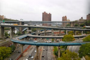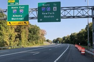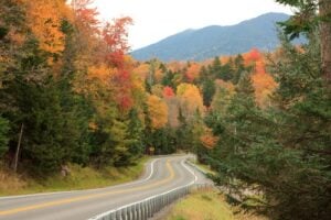
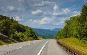
Interstate 87 heading north toward the Adirondack High Peaks region in Essex County, New York. Photo: Daniel Case, CC BY-SA 3.0, via Wikimedia Commons.
Every New Yorker knows the tired debate about where “Upstate” begins. Downstaters may claim it starts at Yonkers or I-287; Westchester residents often push it farther north; people in Albany, Syracuse, and the Mohawk Valley usually have their own definitions. But once you move beyond the Capital Region and the central spine of the Thruway, another question takes over: Where does the North Country actually begin?
New York State has an official answer, but the lived geography is more complicated. The state places Clinton, Essex, Franklin, Hamilton, Jefferson, Lewis, and St. Lawrence counties in the North Country. On the road, however, the transition is not a single painted line. It is cultural, climatic, geographic, and sensory. You notice it in the highways, the radio dial, the food, the businesses, the forests, and the weather.
What New York State Officially Calls the North Country
New York State’s regional maps define the North Country as seven counties: Clinton, Essex, Franklin, Hamilton, Jefferson, Lewis, and St. Lawrence. That official definition includes places as different as Watertown, Plattsburgh, Canton, Potsdam, Malone, Lake Placid, Lowville, and the Adirondack interior.
It also produces one of the first surprises in this debate. Warren County, including Glens Falls and Queensbury, is officially part of the Capital Region rather than the North Country. Yet anyone driving north on I-87 can understand why Glens Falls and Lake George feel like a gateway to something different. The administrative boundary is useful, but the cultural transition happens more gradually. That is part of the same regional argument explored in our article Where Does Upstate New York Begin?
1. The Four Geographic Fronts: Where People Draw the Line
Because the Adirondacks sit in the middle of northern New York, the North Country is approached through several very different corridors. Depending on which road you travel, the region seems to begin in a different place.
- The Glens Falls / Queensbury Gateway: On I-87, the transition is already noticeable around Glens Falls, Queensbury, and Lake George. Officially, this is still the Capital Region, but the suburban texture begins to thin out, Adirondack tourism takes over, and the road starts pointing directly toward the mountains. For many travelers from Albany and points south, this is where the North begins to feel close, even if the state map says the formal North Country lies farther ahead.
- The Watertown Gate: On the western side, Watertown is unquestionably North Country under New York State’s official definition because Jefferson County is one of the seven North Country counties. The city is also the major commercial and military center for the western part of the region, with Fort Drum nearby and the Tug Hill country immediately to the south and east.
- The Route 11 Ribbon: U.S. Route 11 may be the strongest cultural spine of the northern tier. It runs through Watertown, Gouverneur, Canton, Potsdam, Malone, and Rouses Point before reaching the Canadian border. New York State even uses the North Country name for the scenic-byway corridor stretching from Rouses Point toward Canton. Along this route, college towns, dairy country, border communities, river valleys, and small commercial centers form a remarkably consistent northern landscape.
- The “Above the Blue Line” School: Some travelers use the Adirondack Park boundary, commonly called the Blue Line, as their mental border. The Blue Line is a real legal boundary for Adirondack Park, but it is not the same thing as the North Country boundary. The two overlap extensively, yet the North Country also includes places outside the Park, while parts of the Adirondack Park reach into counties that New York State places in other regions.
2. The Cultural Barometers: How the Region Starts to Feel Different
The Stewart’s Shop Metric
Stewart’s Shops are not exclusive to the North Country, and they certainly do not become a literal monopoly once you cross an invisible line. But their presence becomes hard to miss. Stewart’s operates stores in communities including Plattsburgh, Malone, Canton, Potsdam, Ogdensburg, and many smaller towns across northern New York. North Country Public Radio once described the region as being dotted with dozens of Stewart’s locations, which is a fair description of what drivers actually experience.
The deeper north you go, the more the convenience store can function as a practical all-in-one stop: fuel, coffee, milk, ice cream, quick food, propane, and basic road-trip supplies. That does not define the North Country by itself, but it is one of those small roadside signals that tells a traveler the landscape has changed.
The Radio Scan Shift
Nothing marks regional passage faster than scanning the radio dial. North Country Public Radio, based in Canton, operates a network of transmitters covering the Adirondack North Country and reaching into parts of Vermont and Ontario. Its regional newscasts, weather, community calendar, arts coverage, and local reporting give the region a voice that is distinctly its own.
Closer to the international border, Canadian broadcasting also becomes part of the everyday radio landscape. The cultural connection across the border is not an abstraction in places such as Plattsburgh, Malone, Massena, Ogdensburg, and the St. Lawrence Valley. Montreal, Ottawa, Quebec, and Ontario are geographically close enough to influence travel, media, commerce, and daily conversation.
The Food Menu Tells the Tale
The eastern North Country has one food marker that is genuinely difficult to argue with: the Michigan. Around Plattsburgh and the Champlain Valley, a Michigan is a hot dog covered with a seasoned meat sauce and commonly served with mustard and onions. North Country Public Radio has traced the local tradition back to the 1920s and called the Michigan a North Country delicacy.
Cross-border influence also shows up on menus farther west and north. Poutine is easy to find in some restaurants in communities such as Massena and Ogdensburg, reflecting the region’s proximity to Ontario and Quebec. But no single dish defines the entire North Country. The culinary map changes from the Champlain Valley to the Adirondacks, the St. Lawrence Valley, Watertown, and Tug Hill.
There Is No Single “North Country Accent”
The idea of one uniform North Country accent is tempting, especially so close to Canada, but northern New York is linguistically more complicated than that. Speech patterns can change noticeably from one community to another. Linguistic research in St. Lawrence County has even documented a sharp dialect boundary between communities only a few dozen miles apart.
That makes the region more interesting, not less. French-Canadian history, old settlement patterns, Great Lakes connections, rural isolation, college communities, and the international border have all shaped local speech in different ways. You may hear Canadian influence in some speakers and communities, but there is no reliable rule that everyone suddenly says “Nort’ Country,” rounds “about,” or ends sentences with “eh?” once you pass a particular highway exit.
3. Weather as a Geographic Border: The Winter Divide
Perhaps the most convincing North Country boundary is the weather forecast. The National Weather Service treats the region as a distinct forecasting area because northern New York contains several dramatically different winter climates: the Adirondack high country, the St. Lawrence Valley, the Champlain Valley, and the lake-effect belt east of Lake Ontario.
The northern Adirondacks can average near or above 100 inches of snow in a winter, with persistent snowpack and extremely early and late freezes in sheltered high-elevation valleys. The Champlain Valley is milder and generally receives less snow because of lower elevation, terrain effects, and the moderating influence of Lake Champlain. The St. Lawrence Valley has its own winter pattern, while the Tug Hill region can receive extraordinary lake-effect snowfall from Lake Ontario.
That variation matters because the North Country is not simply “colder Upstate.” Its winter geography changes dramatically from one corridor to another. Snow stakes beside rural driveways, heavy municipal plow equipment, long-lasting snowpack, frozen lakes, and winter recreation are all part of daily life across large portions of the region, but the exact experience depends on whether you are in the Adirondacks, along Lake Champlain, in the St. Lawrence Valley, or near Tug Hill.
So Where Does the North Country Really Begin?
The cleanest answer is that there are two North Country lines.
The first is the official one. New York State defines the North Country as Clinton, Essex, Franklin, Hamilton, Jefferson, Lewis, and St. Lawrence counties. If you need a map for government, economic development, statistics, or regional planning, that is the line to use.
The second is the line travelers actually feel. On I-87, the psychological transition starts around Glens Falls, Queensbury, and Lake George before becoming unmistakable farther north. On I-81, Watertown is the western gateway. Across the northern tier, Route 11 ties together many of the communities that most clearly embody North Country life. The Adirondack Blue Line marks another powerful geographic transition, but it describes the Park, not the whole region.
The original temptation is to settle the argument with the 44th parallel, but the map refuses to cooperate. Watertown and Ticonderoga both sit south of 44 degrees north, while large parts of the officially defined North Country extend well south of that latitude. A single east-west line cannot capture a region shaped by mountains, lake-effect snow, river valleys, farms, border crossings, military communities, college towns, and the Adirondack wilderness.
The real answer is less tidy and more New York: the North Country begins as a transition zone, not a ruler-straight line. You know you are entering it when the cities thin out, the distances stretch, the weather becomes a larger part of daily life, Canada starts appearing on road signs and radio dials, and the northern landscape begins to dictate the rhythm of everything around it.
For more on northern New York, see our New York–Canada Border Crossings guide, our look at 10 Historic Small Towns in Upstate New York Worth Visiting, and our feature on 15 Historic Great Camps of the Adirondacks.
Sources
New York State Regional Economic Development Councils — North Country
Adirondack Park Agency — Adirondack Park Boundary and Blue Line GIS Information
New York State Department of Transportation — North Country Scenic Byway
North Country Public Radio — About NCPR and Regional Coverage
North Country Public Radio — Michigans: A North Country Delicacy
National Weather Service Burlington — North Country Snowfall Climatology
Aaron J. Dinkin — “The Foot of the Lake: A Sharp Dialect Boundary in Rural Northern New York”