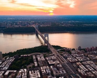
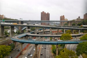
The interchange between the Major Deegan Expressway and the Cross Bronx Expressway in the Bronx, New York. Photo: quiggyt4 / Shutterstock.com
Every road warrior in New York has a personal horror story about a highway interchange. Whether it is a dense stack of ramps in the outer boroughs, a sudden route-number change in the Capital Region, or a high-volume split between major interstates, some junctions demand far more attention than others.
New York’s road network combines mid-20th-century engineering, older parkway systems, major freight corridors, river crossings, mountain gaps, and decades of later reconstruction. The eight interchanges below are ranked editorially for the number of routes involved, the speed and frequency of decision points, unusual route changes, weaving movements, and the likelihood that an unfamiliar driver can become confused. This is not a crash-rate ranking.
Important: Lane configurations, construction zones, signs, and traffic patterns can change. Use this article for trip planning, but always follow current posted signs and real-time traffic information when approaching an interchange.
1. Alexander Hamilton Bridge Interchange: I-95 and I-87 in the Bronx
- The Highways: Interstate 95 on the Cross Bronx Expressway, Interstate 87 on the Major Deegan Expressway, the Alexander Hamilton Bridge, and nearby Harlem River Drive connections.
- Why It Is Complicated: This is where two of the most important interstate corridors in New York City meet immediately beside a major Harlem River crossing. NYSDOT says the Alexander Hamilton Bridge carries I-95 between Manhattan and the Bronx and connects with a system of ramps serving I-87 and the Major Deegan Expressway. The interchange serves enormous volumes of passenger and commercial traffic, and drivers approaching from either interstate must read signs early because several ramps divide traffic within a confined urban highway corridor.
- Navigation Tip: Decide before reaching the interchange whether you are continuing on I-95 or transferring to I-87. Follow the overhead interstate shields and avoid making a last-second lane change once the ramps begin to separate.
2. Suffern / Mahwah Border Complex: I-87, I-287, NJ Route 17 and NY Route 17
- The Highways: New York State Thruway I-87, Interstate 287, New Jersey Route 17, New York Route 17, and Route 59.
- Why It Is Complicated: The state line near Suffern and Mahwah compresses several major regional routes into a short distance. Thruway Exit 15 serves New Jersey, I-287, and NJ Route 17 South, while Exit 15A just over a mile farther north serves Sloatsburg, Suffern, NY Route 17 North, and Route 59. The close spacing of these exits, combined with heavy commuter and freight traffic, makes the corridor especially easy to misread for drivers who are unfamiliar with the New York-New Jersey border network.
- Navigation Tip: Know whether your destination requires Exit 15 or Exit 15A before entering the Suffern corridor. The route numbers and destinations are more useful than trying to improvise from lane position at the last moment.
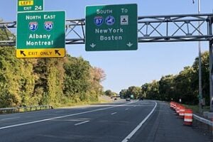
3. Albany Exit 24: Where the Thruway, I-87 and I-90 Change Identities
- The Highways: Interstate 87, Interstate 90, the New York State Thruway, and the Adirondack Northway.
- Why It Is Complicated: Albany Exit 24 is one of New York’s most counterintuitive highway junctions because the physical Thruway and the interstate route numbers stop matching in the way many drivers expect. The Thruway Authority lists Exit 24 for Albany, Montreal, I-90 East, and I-87 North. Northbound I-87 leaves the Thruway here to continue on the Adirondack Northway, while the Thruway itself continues west carrying I-90 toward Schenectady, Syracuse, Rochester, and Buffalo. I-90 approaching from the west also leaves the Thruway here to continue east through Albany.
- Navigation Tip: Follow the destination and interstate shields rather than assuming that remaining on the same physical roadway means remaining on the same interstate number.
4. Kew Gardens Interchange: Grand Central, Van Wyck and Jackie Robinson in Queens
- The Highways: Grand Central Parkway, Van Wyck Expressway (I-678), Jackie Robinson Parkway, Union Turnpike, and nearby Queens Boulevard connections.
- Why It Is Complicated: NYSDOT describes Kew Gardens as the complex intersection of the Grand Central Parkway, Van Wyck Expressway, Jackie Robinson Parkway, and Union Turnpike, serving nearly 600,000 vehicles per day. The state has spent more than $700 million across four major construction contracts to rebuild bridges, lengthen merges, widen ramps, improve sight distance, and simplify traffic movements. Even after major improvements, it remains a dense, multi-level interchange where several major Queens corridors meet in a small area.
- Navigation Tip: Read the overhead signs before entering the interchange and commit to the signed route early. Drivers heading toward JFK Airport should track I-678 and Van Wyck Expressway signs rather than relying only on neighborhood names.
5. Harriman / Woodbury Exit 16: The Thruway Meets Route 17
- The Highways: New York State Thruway I-87, U.S. Route 6, and New York Route 17.
- Why It Is Complicated: Thruway Exit 16 is the major connection for Harriman, U.S. Route 6, and Route 17, placing it at a gateway between the lower Hudson Valley, the Catskills, and the Southern Tier corridor. The area also carries substantial regional shopping and tourism traffic associated with Woodbury and the surrounding Orange County corridor. Route 17 east of the Thruway remains the subject of a long-term NYSDOT effort to upgrade portions of the highway to interstate standards for eventual I-86 designation, adding another layer of route identity to an already busy junction.
- Navigation Tip: If you are transferring between the Thruway and Route 17, begin following the Harriman, Route 17, and U.S. 6 signs well before the ramp system. Holiday and weekend traffic can make the decision area feel more compressed than it appears on a map.
6. Bruckner Interchange: I-95, I-278, I-295, I-678 and the Hutchinson River Parkway
- The Highways: I-95, I-278, I-295, I-678, the Bruckner and Cross Bronx expressways, the Whitestone Expressway, and the Hutchinson River Parkway. The Throgs Neck Expressway (I-695) begins nearby to the north.
- Why It Is Complicated: Few places in New York combine as many different route types in one highway complex. NYSDOT describes the Bruckner Interchange as the meeting point of I-95, I-278, I-295, I-678, and the Hutchinson River Parkway. Traffic is sorting among New England, Manhattan, Queens, Long Island, and Bronx destinations while passenger vehicles and commercial vehicles face different route restrictions. Trucks are not permitted on the Hutchinson River Parkway, making correct route selection especially important for commercial drivers.
- Navigation Tip: Commercial drivers should remain on routes specifically signed for truck traffic and never follow a passenger-car parkway route. Other drivers should decide well in advance whether they are headed toward the Whitestone Bridge, the Throgs Neck corridor, New England, or the Cross Bronx.
7. Rochester’s Former “Can of Worms”: I-490 and I-590
- The Highways: Interstate 490, Interstate 590, and New York Route 590.
- Why It Is Complicated: The I-490/I-590 interchange became famous locally as the “Can of Worms” because its original design featured difficult weaving movements and closely spaced ramps. The worst geometry was extensively rebuilt decades ago, which is why NYSDOT now refers to the location as the former Can of Worms. Even in its modern form, however, it remains one of Rochester’s most important freeway junctions, with traffic moving between downtown, Brighton, Pittsford, Irondequoit, and the eastern suburbs through several ramps in quick succession.
- Navigation Tip: Treat the nickname as history, not as an excuse to expect the old road layout. Follow current I-490, I-590, and NY 590 signs and allow room for traffic entering and leaving around the interchange.
8. Binghamton’s Prospect Mountain Interchange: I-81 and Route 17
- The Highways: Interstate 81 and New York Route 17, with Interstate 88 beginning a few miles to the north on I-81.
- Why It Is Complicated: I-81 and Route 17 converge in Binghamton and share roadway through part of the Prospect Mountain corridor before separating again. NYSDOT undertook a major two-phase reconstruction of the interchange, replacing bridges, rebuilding ramps, reducing weaving, and improving traffic flow. The larger regional highway network also sends I-88 traffic toward Albany from north of Binghamton. Route 17 remains part of New York’s long-running conversion program toward Interstate 86 designation, although the Binghamton city segment has not simply become I-86 throughout.
- Navigation Tip: Watch the route shields closely through the shared I-81/Route 17 section and make sure you know whether your next movement is toward Syracuse, the Southern Tier, or the I-88 corridor toward Albany.
Quick Reference: How to Approach New York’s Most Complicated Interchanges
| Interchange | Main Source of Confusion | Best Preparation |
|---|---|---|
| Alexander Hamilton Bridge | I-95 and I-87 split beside a major urban bridge and dense ramp network | Choose I-95 or I-87 before the ramps begin separating |
| Suffern / Mahwah | Closely spaced border exits for I-287, NJ 17, NY 17, and Route 59 | Know whether you need Exit 15 or Exit 15A |
| Albany Exit 24 | The Thruway, I-87, and I-90 change route relationships | Follow destinations and interstate shields, not roadway inertia |
| Kew Gardens | Multiple major Queens highways meet in a multi-level interchange | Read overhead signs early and commit to the signed route |
| Harriman / Woodbury | Thruway traffic meets Route 17, U.S. 6, regional tourism, and shopping traffic | Track Route 17 and Harriman signs before reaching Exit 16 |
| Bruckner Interchange | Five major route systems plus different truck and parkway rules | Commercial vehicles must avoid parkways; verify bridge and interstate destination early |
| Rochester Can of Worms | I-490, I-590, and NY 590 movements occur close together | Follow current signs rather than relying on the interchange’s old reputation |
| Binghamton Prospect Mountain | I-81 and Route 17 overlap and then separate within a major regional corridor | Track route shields for Syracuse, the Southern Tier, and Albany connections |
For more on driving across New York, see our guide to the history of E-ZPass in New York and how to sign up, our look at New York State Thruway rest stops, and 65 years of local advice on how to get around New York City.
Sources
New York State Department of Transportation — Alexander Hamilton Bridge Interchange
New York State Thruway Authority — Interchange and Exit Listing
New York State Department of Transportation — Kew Gardens Interchange Project
New York State Department of Transportation — Route 17 to I-86 Enhancements Initiative
New York State Department of Transportation — Bruckner Interchange Traffic Study
New York State Department of Transportation — Parkway Commercial Vehicle Restrictions
New York State Department of Transportation — Former Can of Worms Interchange
New York State Department of Transportation — I-81/Route 17 Prospect Mountain Reconstruction
Updated September 21, 2026.