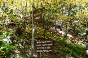
New York–Massachusetts border sign near Bash Bish Falls State Park in the Taconic Mountains. Photo: Sunnyside Productions / Shutterstock.com
New York and Massachusetts share a relatively short border compared with New York’s boundaries with Pennsylvania or Canada, but the crossings are unusually varied. Interstate 90 provides the major high-speed connection between the Capital Region and the Massachusetts Turnpike, while a series of older two-lane highways cross the Taconic range into the Berkshires through places such as New Lebanon, Petersburg, Hillsdale, Canaan, and the Green River valley.
For travelers, the most important distinction is simple: Interstate 90 is the only major tolled highway crossing between the two states. The other principal road crossings are toll-free, but some climb through steep mountain terrain where winter weather can make travel much more difficult than the mileage alone would suggest.
Travel note: Toll rates, winter road conditions, construction, and temporary restrictions can change. Drivers should check 511NY, Massachusetts 511, the New York State Thruway Authority, and MassDOT before traveling.
Are New York–Massachusetts Border Crossings Tolled?
Most direct road crossings between New York and Massachusetts are toll-free. Interstate 90 is the important exception. On the New York side, I-90 follows the Berkshire Connector of the New York State Thruway before reaching the Massachusetts line. On the Massachusetts side, it becomes the Massachusetts Turnpike.
As of 2026, the New York State Thruway Authority lists the Class 2L passenger-car toll between Exit B1 on the Berkshire Connector and the Massachusetts state line at $0.83 with a New York E-ZPass and $1.45 with either a non-New York E-ZPass or Tolls by Mail. New York’s discounted rate applies to E-ZPassNY accounts, and transactions that must be posted by license plate are charged at the Tolls by Mail rate.
Massachusetts also uses all-electronic tolling. Drivers with E-ZPass pass beneath overhead gantries without stopping. Drivers without a transponder are billed through Pay By Plate, which uses cameras to photograph the vehicle’s license plate and sends an invoice to the registered owner. Massachusetts distinguishes among E-ZPass MA, out-of-state E-ZPass, and Pay By Plate payment methods, and Pay By Plate invoices include an additional invoice fee. Because Massachusetts tolls depend on how far a driver travels on the Turnpike and how the toll is paid, travelers should use the official EZDriveMA toll calculator for the exact trip rather than relying on one flat statewide figure.
For more on how electronic tolling works in New York, see our The Story of E-ZPass in New York and How to Sign Up.
Interstate 90 — Canaan to West Stockbridge
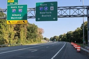
Interstate 90 is the principal highway crossing between New York and Massachusetts. It crosses the state line between Canaan in Columbia County, New York, and West Stockbridge in Berkshire County, Massachusetts. On the New York side, the highway is part of the Berkshire Connector. At the state line, it becomes the Massachusetts Turnpike.
This is the main route for passenger cars, buses, and long-distance freight moving between Albany and the Capital Region, the Berkshires, Springfield, Worcester, and Boston. The highway is built for heavy interstate traffic, but the terrain becomes noticeably more mountainous as it enters western Massachusetts.
Drivers heading east from New York should remember that tolling continues on both sides of the border. There are no cash booths; both states rely on electronic tolling and license-plate billing.
U.S. Route 20 — New Lebanon to Hancock
U.S. Route 20 crosses from New Lebanon in Columbia County into Hancock, Massachusetts. It is the principal toll-free east-west alternative to Interstate 90 in this part of the border and continues through the Berkshires toward Pittsfield before running across Massachusetts.
The New York side passes through the historic New Lebanon area and near the Mount Lebanon Shaker community. The road then climbs toward the Massachusetts line before descending into Hancock and the central Berkshires. It carries passenger vehicles, local commercial traffic, and a large amount of seasonal tourism traffic.
Route 20 is slower than Interstate 90 but gives travelers direct access to local communities that the Turnpike bypasses.
New York Route 2 / Massachusetts Route 2 — Petersburg Pass
New York Route 2 crosses the Massachusetts line east of Petersburg in Rensselaer County and continues as Massachusetts Route 2 toward Williamstown. This is one of the most dramatic road crossings between the two states because the highway climbs over Petersburg Pass along the Taconic range at an elevation of just over 2,000 feet.
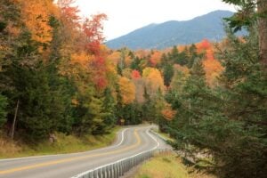
The crossing is toll-free, but the steep grades, curves, and elevation make weather an important factor. Snow, freezing rain, fog, and rapidly changing mountain conditions can make the route difficult during winter storms. In clear weather, however, this is one of the most scenic ways to travel between eastern New York and northern Berkshire County.
Massachusetts Route 2 continues through Williamstown and North Adams before following the historic Mohawk Trail east across northern Massachusetts.
New York Route 23 / Massachusetts Route 23 — Hillsdale to Egremont
New York Route 23 crosses the state line east of Hillsdale in Columbia County and continues into Egremont, Massachusetts. It is one of the most important southern Berkshire crossings for travelers coming from Hudson, Columbia County, and the Taconic State Parkway.
The route is toll-free and provides direct access toward Great Barrington and the southern Berkshires. Catamount Mountain Resort sits directly along the state line in this area, making Route 23 especially busy during ski season, summer recreation periods, and the fall foliage season.
For travelers headed toward Great Barrington without using the Massachusetts Turnpike, Route 23 is one of the most practical crossings.
New York Route 295 / Massachusetts Route 295 — Canaan to Richmond
New York Route 295 runs east from Chatham through Columbia County and reaches the Massachusetts state line in the Town of Canaan. The road continues into Richmond, Massachusetts, providing a quieter two-lane connection into central Berkshire County.
This crossing is toll-free and carries mostly local passenger traffic, regional commuters, and visitors traveling between Chatham, Canaan, Richmond, Pittsfield, and nearby Berkshire communities. It is far less heavily traveled than Interstate 90, which runs only a short distance to the north.
New York Route 71 / Massachusetts Route 71 — Green River to Alford
New York Route 71 is a short state highway in southern Columbia County that runs from New York Route 22 to the Massachusetts state line near Green River. The road continues into Massachusetts toward Alford and Great Barrington.
This is a rural, toll-free crossing through one of the quieter parts of the Taconic foothills. It is used primarily by local residents, farm traffic, cyclists, and travelers moving between the Hillsdale area and southwestern Berkshire County.
What About New York Route 7?
New York Route 7 is sometimes associated with travel between the Albany–Troy area and the northern Berkshires, but it does not cross directly into Massachusetts. NY 7 travels east through Rensselaer County toward Hoosick and the Vermont state line. Drivers heading from the Troy area toward Williamstown generally connect to other routes, including New York Route 2, before entering Massachusetts.
That distinction matters because a New York–Massachusetts crossing guide should not list NY 7 as a direct state-line crossing.
Local Roads Near Mount Washington and the Southern State Line
Near the southern end of the New York–Massachusetts border, several local roads cross between Columbia County and the rural towns of southwestern Berkshire County around Mount Washington, Egremont, and Alford. These are not major through highways and can be narrow, steep, or lightly maintained compared with the state routes farther north.
Travelers using these local crossings should rely on current navigation and road-condition information, especially in winter. The area includes state forests, hiking access, Bash Bish Falls, and sections of the South Taconic landscape, so some roads are used more for local and recreational access than for interstate through travel.
New York to Massachusetts by Train
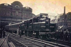
The New York–Massachusetts border can also be crossed by passenger rail. Amtrak’s Lake Shore Limited operates daily between New York and Chicago, with a Boston section that runs between Albany-Rensselaer and Boston through the Berkshires.
The train crosses from New York into Massachusetts west of Pittsfield and stops in Pittsfield before continuing east toward Springfield, Worcester, and Boston. Amtrak restored direct train service between Albany and Boston in December 2025 after a period when substitute buses were used because of infrastructure problems west of the Massachusetts line.
Which New York–Massachusetts Crossing Should You Use?
For the fastest trip between Albany and Boston, Interstate 90 is the obvious choice, but it is also the only major crossing in this corridor where drivers should expect tolls on both sides of the state line. U.S. Route 20 is the best-known toll-free alternative for travelers headed toward Pittsfield and the central Berkshires.
Route 2 is the most direct scenic crossing for Williamstown and North Adams, but Petersburg Pass can be challenging in winter. Route 23 is a strong choice for Great Barrington and the southern Berkshires, while Routes 295 and 71 serve quieter local trips through Columbia County and western Massachusetts.
For more New York transportation information, read our The Story of E-ZPass in New York and How to Sign Up and Visiting the Just Opened New York State Thruway Rest Stops.