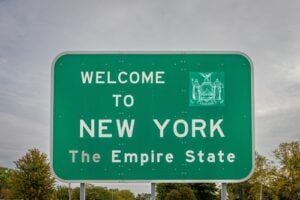
Welcome to New York sign at the Pennsylvania–New York state line. Photo: Gestalt Imagery / Shutterstock.com
New York shares a long southern border with Pennsylvania, stretching from Lake Erie across the Southern Tier to the Delaware River and then following the river south toward Port Jervis. Unlike the New York–New Jersey crossings around New York City, most New York–Pennsylvania crossings are highways, rural roads, or river bridges rather than heavily tolled urban gateways.
The major routes range from Interstate 90 near Lake Erie and Interstate 81 south of Binghamton to the Delaware River bridges connecting communities such as Hancock, Callicoon, Narrowsburg, Barryville, and Port Jervis with neighboring towns in Pennsylvania. This guide focuses on the principal highway and bridge crossings travelers are most likely to use, along with several historic local crossings that are part of the character of the border itself.
Travel note: Construction, weight restrictions, weather closures, and toll policies can change. Before traveling, especially during winter or when using one of the smaller Delaware River bridges, check 511NY, 511PA, and the appropriate transportation agency.
Are New York–Pennsylvania Border Crossings Tolled?
Most direct road and bridge crossings between New York and Pennsylvania do not charge a toll at the state line. The major exception travelers need to understand is Interstate 90, which becomes part of the New York State Thruway as it enters New York from Pennsylvania. There is no traditional cash tollbooth at the border, but drivers pass through the Thruway’s cashless tolling system after entering New York.
As of 2026, the New York State Thruway Authority’s toll calculator lists a Class 2L passenger vehicle traveling through the Ripley-to-Lackawanna toll segment at $3.12 with a New York E-ZPass and $5.46 with a non-New York E-ZPass or Tolls by Mail. The Thruway gives its discounted electronic rates to E-ZPassNY accounts; an E-ZPass issued by another state can still be used, but it may be charged the higher non-New York rate. If a toll is billed by license plate rather than a properly read transponder, the Tolls by Mail rate applies.
That distinction is important for anyone using I-90 regularly. Drivers without E-ZPass do not stop to pay cash. Cameras photograph the license plate and a bill is sent to the vehicle’s registered owner. For a deeper look at how the system works, see our The Story of E-ZPass in New York and How to Sign Up.
Interstate 90 — Ripley and the Lake Erie Crossing
Interstate 90 crosses from Erie County, Pennsylvania, into Chautauqua County, New York, near Ripley. It is the principal high-speed crossing along the Lake Erie corridor and carries a large volume of passenger traffic and interstate freight between Erie, Buffalo, Cleveland, and points farther west.
The physical state line is close to the western end of the New York State Thruway. Drivers entering New York soon encounter the Ripley tolling area as part of the Thruway’s all-electronic system. This stretch is also one of the New York crossings most vulnerable to lake-effect snow, and both New York and Pennsylvania periodically impose speed reductions or commercial-vehicle restrictions during severe winter weather.
Interstate 86 — Western New York and the Waverly Border
Interstate 86 has an unusual relationship with the New York–Pennsylvania border. At its western end, I-86 begins in Pennsylvania near Interstate 90 and enters New York near Findley Lake. Farther east, the Southern Tier Expressway briefly dips back into Pennsylvania around South Waverly before returning to New York. New York State has continued extending the I-86 designation eastward as additional sections of Route 17 are upgraded to interstate standards.
The Southern Tier Expressway links communities including Jamestown, Olean, Hornell, Corning, Elmira, Waverly, and the Binghamton region. The South Waverly section is particularly unusual because a short stretch of the highway lies in Pennsylvania while remaining closely tied to the New York highway network.
Interstate 81 — Binghamton to Pennsylvania
Interstate 81 crosses the state line between Kirkwood in Broome County and Great Bend in Susquehanna County, Pennsylvania. It is one of the most important north-south freight routes in the region, connecting Pennsylvania and the Mid-Atlantic with Binghamton, Syracuse, Watertown, and the Canadian border at the Thousand Islands.
There is no toll at the New York–Pennsylvania state line. The highway carries heavy commercial traffic in both directions, and winter weather can affect travel quickly in the hills south of Binghamton. For long-distance drivers headed toward Scranton or north toward Syracuse, this is one of the most heavily used crossings between the two states.
Interstate 99 / U.S. Route 15 — Lindley to Lawrenceville
Interstate 99 and U.S. Route 15 cross the state line between Lindley in Steuben County and Lawrenceville in Tioga County, Pennsylvania. The four-lane divided highway connects the Corning and Painted Post area with Mansfield, Williamsport, and central Pennsylvania.
This crossing is toll-free and has become a useful north-south route for both passenger vehicles and commercial traffic. It also provides direct access toward the Corning Museum of Glass and the Finger Lakes from central Pennsylvania.
Interstate 84 — Port Jervis to Matamoras
Interstate 84 crosses directly from Orange County, New York, into Pike County, Pennsylvania, over the Delaware River between the Port Jervis area and Matamoras. It does not pass through New Jersey before entering Pennsylvania. That distinction is easy to miss because New York, New Jersey, and Pennsylvania come together within a very small area near Port Jervis.
The I-84 crossing is toll-free and carries passenger cars, buses, and interstate freight. It provides an important route between the Hudson Valley and northeastern Pennsylvania and connects with Interstate 81 near Scranton. The highway bridge is separate from the local U.S. Routes 6 and 209 bridge between downtown Port Jervis and Matamoras.
U.S. Routes 6 and 209 — Port Jervis to Matamoras
The Port Jervis–Matamoras Bridge carries U.S. Routes 6 and 209 across the Delaware River between downtown Port Jervis and Matamoras. This local crossing is different from the nearby I-84 bridge and is useful for drivers traveling between the two communities or heading toward Milford and the Upper Delaware River corridor.
The bridge is one of the interstate spans overseen through the New York–Pennsylvania bridge arrangement and provides a direct connection between the two states without a toll.
U.S. Route 219 — Bradford to Western New York
U.S. Route 219 crosses the state line between McKean County, Pennsylvania, and Cattaraugus County, New York, continuing north toward Salamanca, Ellicottville, Springville, and the Buffalo region. It is a major regional route for passenger vehicles, commercial traffic, and travelers headed toward Allegany State Park and the ski areas around Ellicottville.
The road is toll-free at the border. Unlike the interstates, portions of U.S. 219 change between divided highway and conventional two-lane roadway, so travel speeds vary considerably along the route.
Other Important Surface-Road Crossings
Several major surface highways also cross the New York–Pennsylvania line. U.S. Route 20 enters New York near Ripley and continues east across the state. U.S. Route 62 crosses the line south of Frewsburg and continues north through western New York toward Buffalo and Niagara Falls. New York Route 19 begins at the Pennsylvania line and runs north through Wellsville, while New York Route 14 crosses the border south of Elmira and continues through the Finger Lakes region toward Lake Ontario.
New York Route 328 also reaches the Pennsylvania state line south of Elmira. These crossings are important for local and regional traffic and provide alternatives to the interstate system for travelers moving between Pennsylvania’s Northern Tier and New York’s Southern Tier.
The Upper Delaware River Bridges
From Hancock south toward Port Jervis, the Delaware River forms the state line between New York and Pennsylvania. A network of local bridges ties together communities on both sides of the river. For much of the twentieth century, ten of these interstate bridges were administered through an agreement between New York and Pennsylvania, with maintenance responsibilities divided between the two states.
The bridge network has included the Hancock–Buckingham Bridge, Lordville–Equinunk Bridge, Kellams–Stalker Bridge, Callicoon–Damascus Bridge, Cochecton–Damascus Bridge, Skinners Falls–Milanville Bridge, Narrowsburg–Darbytown Bridge, Pond Eddy Bridge, Barryville–Shohola Bridge, and Port Jervis–Matamoras Bridge. These crossings are generally small two-lane bridges rather than major interstate structures, but they are essential to the river communities that use them every day.
The Callicoon–Damascus Bridge Is Under Reconstruction
The Callicoon Bridge connects Callicoon in Sullivan County with Damascus Township in Pennsylvania. It is undergoing a major reconstruction project, and NYSDOT has used temporary full closures during portions of the work. The project remains under construction in 2026, so travelers should check 511NY before using the crossing.
The bridge remains especially important because there are long stretches of the Upper Delaware where there is no nearby alternative crossing. A closure that looks minor on a map can mean a substantial detour along the river.
Skinners Falls Is No Longer an Active Crossing
The Skinners Falls Bridge once connected Sullivan County, New York, with Wayne County, Pennsylvania, but it is no longer available as a crossing. The bridge had been closed to all traffic, including pedestrians and bicycles, since 2019 because of structural problems. After inspections found critical deterioration, PennDOT removed the bridge in 2025.
That makes Skinners Falls an important historical part of the border-crossing network but not a route travelers can use today. PennDOT continues to study whether a replacement crossing should eventually be built.
Roebling’s Delaware Aqueduct — A Border Crossing With Brooklyn Bridge History
One of the most remarkable New York–Pennsylvania crossings is Roebling’s Delaware Aqueduct between Minisink Ford, New York, and Lackawaxen, Pennsylvania. John A. Roebling began building the aqueduct in 1847 for the Delaware and Hudson Canal, decades before his work on the Brooklyn Bridge. The National Park Service identifies it as the oldest existing wire suspension bridge in the United States.
The aqueduct later became a road crossing and today functions as a one-lane vehicular bridge with pedestrian walkways on both sides. The National Park Service limits vehicles to a gross weight of 10 tons and posts a 15 mph speed limit. The bridge is open year-round, although pedestrian access can be affected by snow and hazardous weather. The old toll house still stands on the New York side, but drivers no longer pay to cross.
Western New York and Pennsylvania by Train
The New York–Pennsylvania border can also be crossed by passenger rail. Amtrak’s Lake Shore Limited operates daily between New York and Chicago, traveling between Buffalo-Depew in New York and Erie in Pennsylvania before continuing west toward Cleveland and Chicago.
For travelers who do not want to drive the I-90 corridor, the train provides a direct interstate connection between western New York and northwestern Pennsylvania, although its schedule is built around long-distance travel rather than frequent local commuting.
Winter Travel Along the New York–Pennsylvania Border
Weather deserves special attention on this border. The I-90 and I-86 corridors near Lake Erie regularly experience intense lake-effect snow, while I-81, I-99, and the rural highways of the Southern Tier can also become difficult during winter storms. New York and Pennsylvania both use temporary speed restrictions and commercial-vehicle controls when conditions become severe.
Drivers should check both 511NY and 511PA before crossing during a winter storm because restrictions may differ on opposite sides of the state line. Conditions can also change rapidly between the lower elevations and the hillier sections of the Southern Tier and northern Pennsylvania.
For more New York transportation history and travel information, read our The Story of E-ZPass in New York and How to Sign Up, Visiting the Just Opened New York State Thruway Rest Stops, and 10 Most Iconic Bridges in New York.
Sources
New York State Thruway Authority — Toll and Distance Calculator
New York State Department of Transportation — New York State Touring Route Descriptions
New York State Department of Transportation — Callicoon Bridge Project
Pennsylvania Department of Transportation — Skinners Falls Bridge Project
National Park Service — Roebling’s Delaware Aqueduct
National Park Service — Roebling Bridge Vehicle and Speed Limits
Amtrak — Lake Shore Limited Timetable